

End-to-End Drone Consulting & Solutions
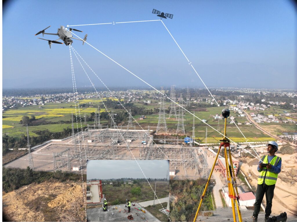
Regulatory Permissions & Compliance
We guide clients through the entire regulatory process, including obtaining drone flight permissions, coordinating with authorities, and ensuring compliance with national aviation and data regulations. This ensures smooth, legal, and risk-free operations from project initiation to completion.
Mission Planning & Project Design
Our experts develop detailed mission plans tailored to project objectives, terrain, airspace, and data requirements. Services include flight planning, sensor selection, accuracy assessment, and risk evaluation to ensure efficient and reliable data collection.
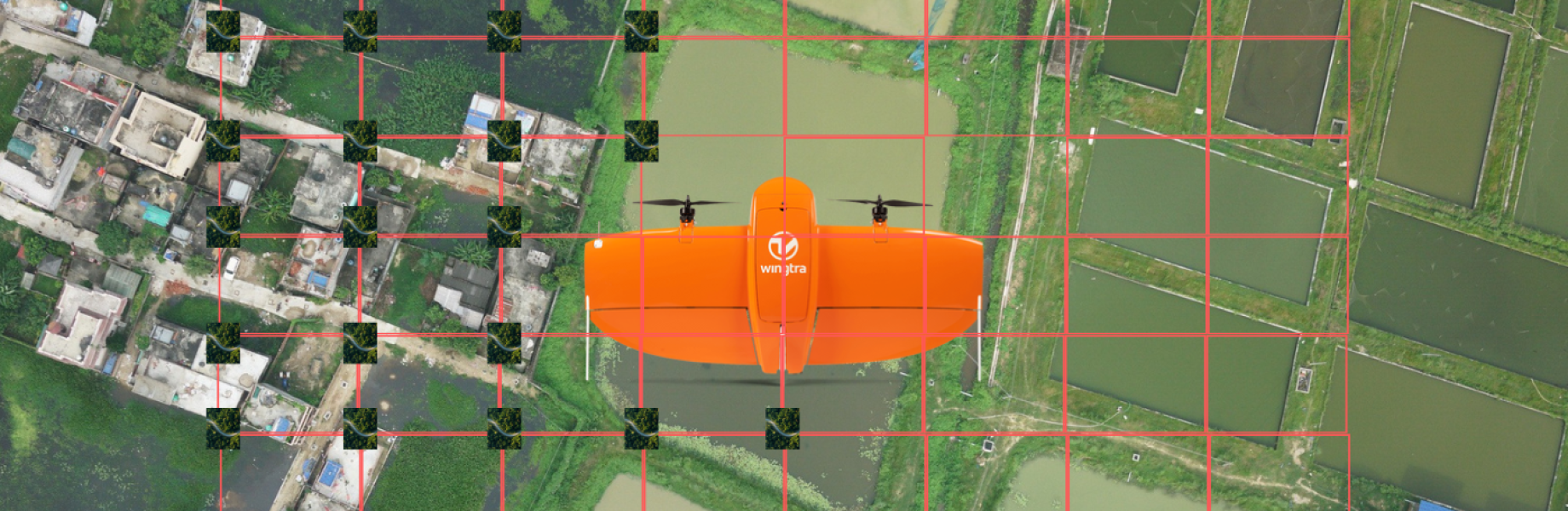
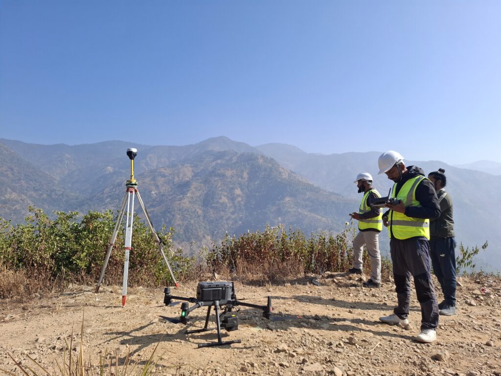
Data Acquisition
Geovation Nepal performs professional drone data collection using advanced UAV platforms and sensors such as LiDAR, RGB, and multispectral cameras. All operations are conducted by trained pilots following standard procedures for high-quality and consistent data capture.
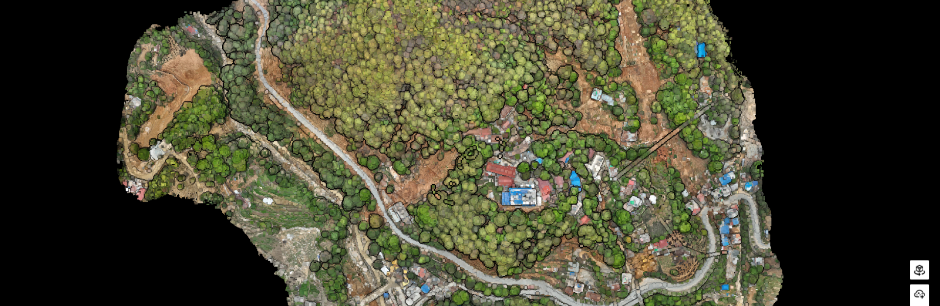
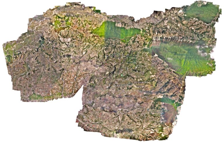
Data Processing & Analysis
Collected data is processed using industry-standard software to generate accurate outputs, including point clouds, orthomosaics, DEMs, DSMs, contour maps, and thematic analyses tailored to project requirements.
Decision-Ready Outputs & Reporting
We deliver clear, actionable, and decision-ready outputs in formats suitable for engineers, planners, researchers, and decision-makers. Deliverables include maps, models, reports, and GIS-ready datasets supporting planning, monitoring, and informed decision-making.
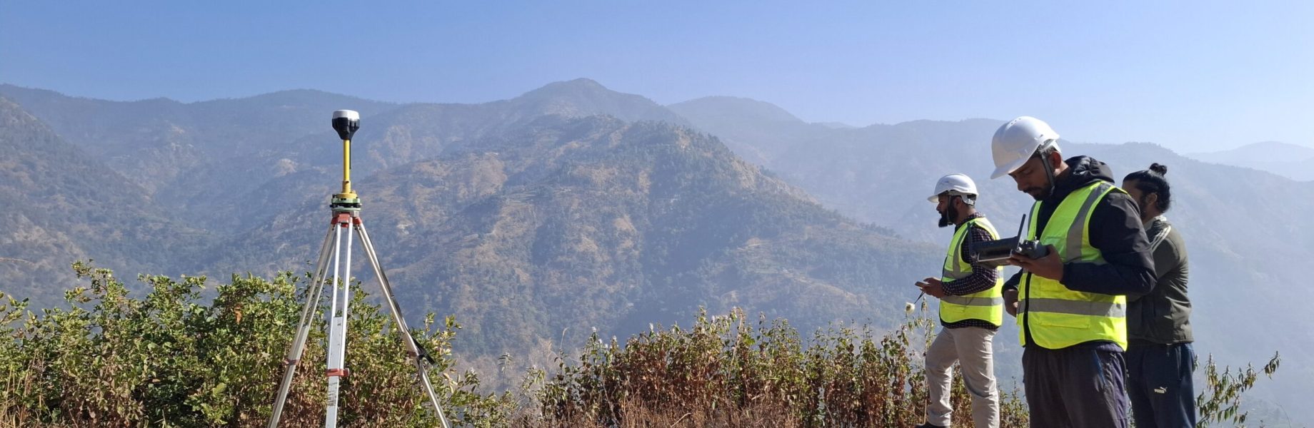
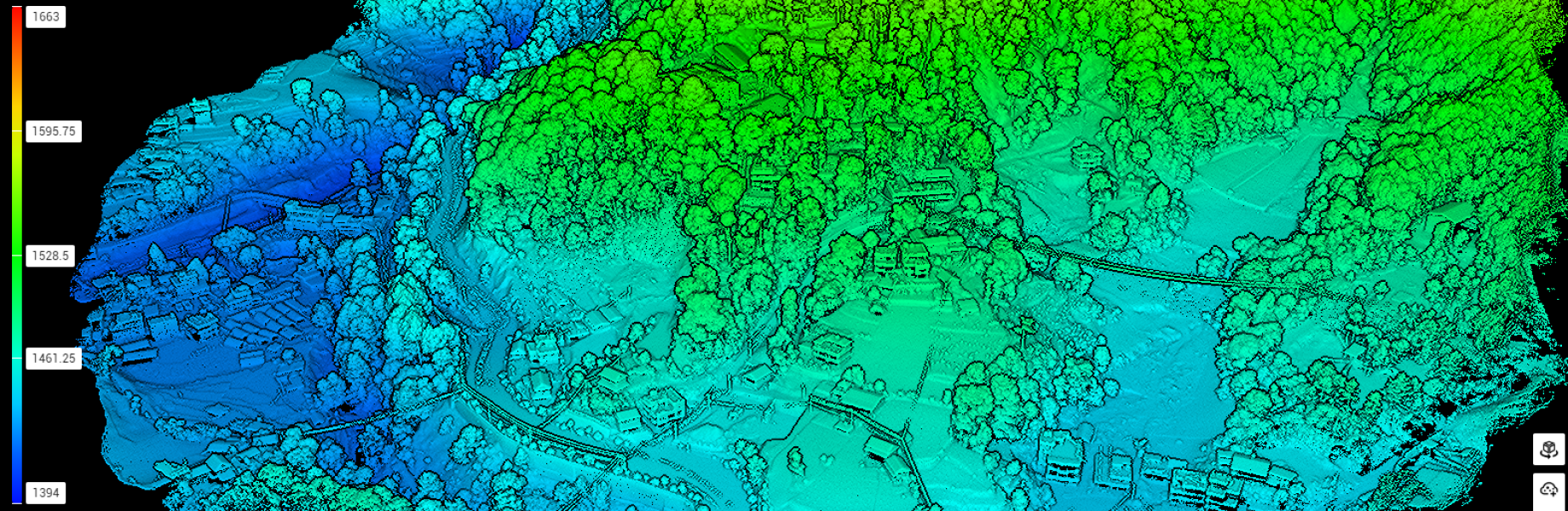
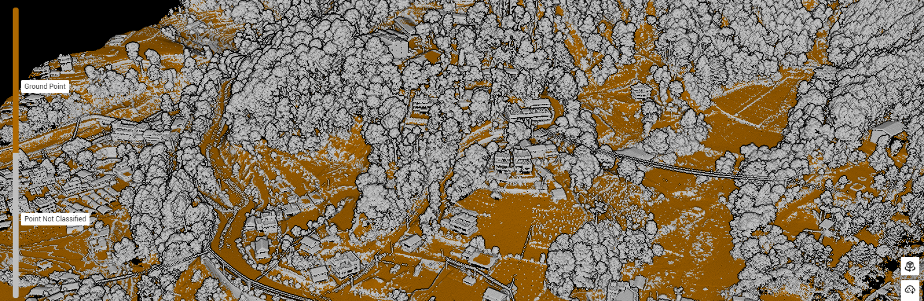
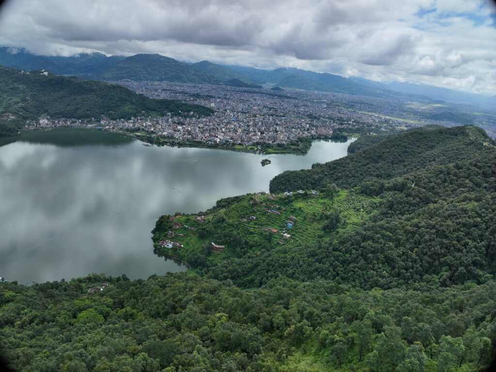
Drone-Based Surveying
High-Precision Data Acquisition
Using docking stations for continuous and scheduled flights, enabling consistent data collection without manual intervention.
LiDAR Terrain & Feature Mapping
Collecting detailed images, 3D models, and topographical data for accurate project tracking.
Photogrammetric Mapping & 3D Modeling
Providing instant updates on milestones, work completion, and potential delays.
Efficient, Safe, & Cost-Effective Operations
Ideal for construction, infrastructure, and energy projects across vast areas.
Applications Across Multiple Sectors
Helping projects stay on schedule and within budget by streamlining monitoring and reducing manual effort.
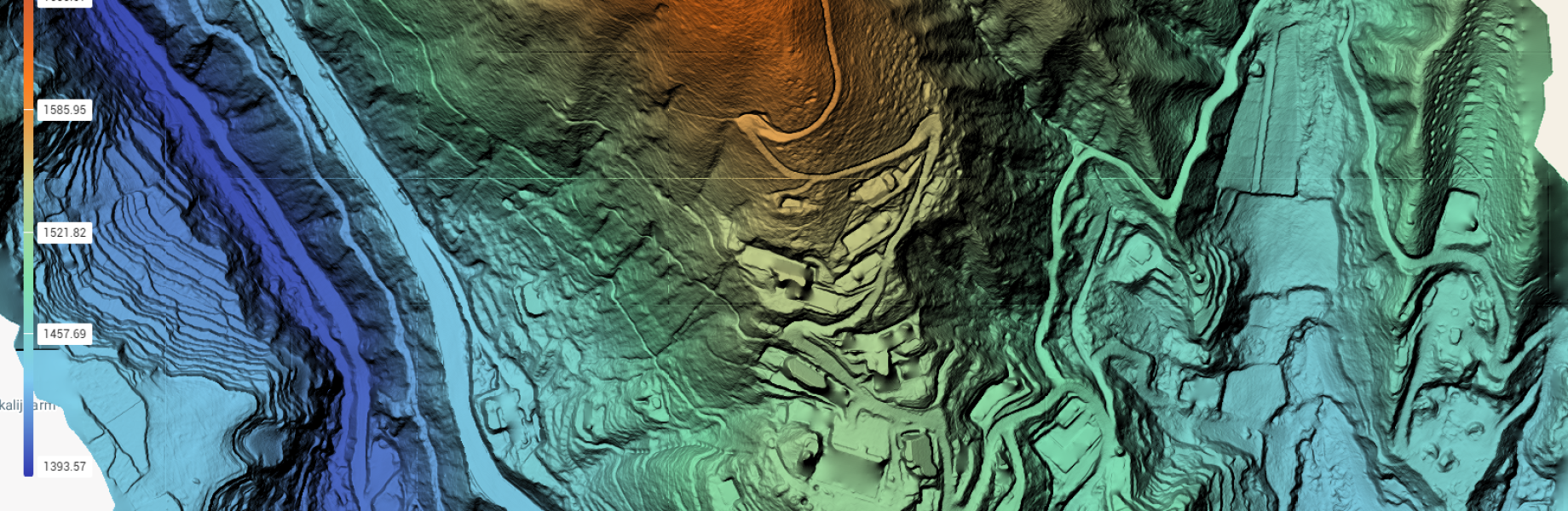
Spatial Data Analysis & GIS Mapping
Raw Data Processing
We convert drone-collected imagery, LiDAR point clouds, and other survey data into clean, georeferenced datasets, applying filtering, noise removal, and alignment to ensure high accuracy.
Thematic & Visual Mapping
Solar farms, wind turbines, power lines, and substations.
Integration with Decision-Support Systems
Track land changes, vegetation health, and environmental impacts.
Large-Scale Coverage
Ideal for construction, infrastructure, and energy projects across vast areas.
Multi-Sector Applications
Rapid inspection after natural disasters to guide recovery and planning.
Advanced Spatial Analysis
Using GIS tools, we perform terrain modeling, slope analysis, flood and risk assessment, watershed mapping, and land-use classification, revealing patterns not visible in raw data to support planning and management.
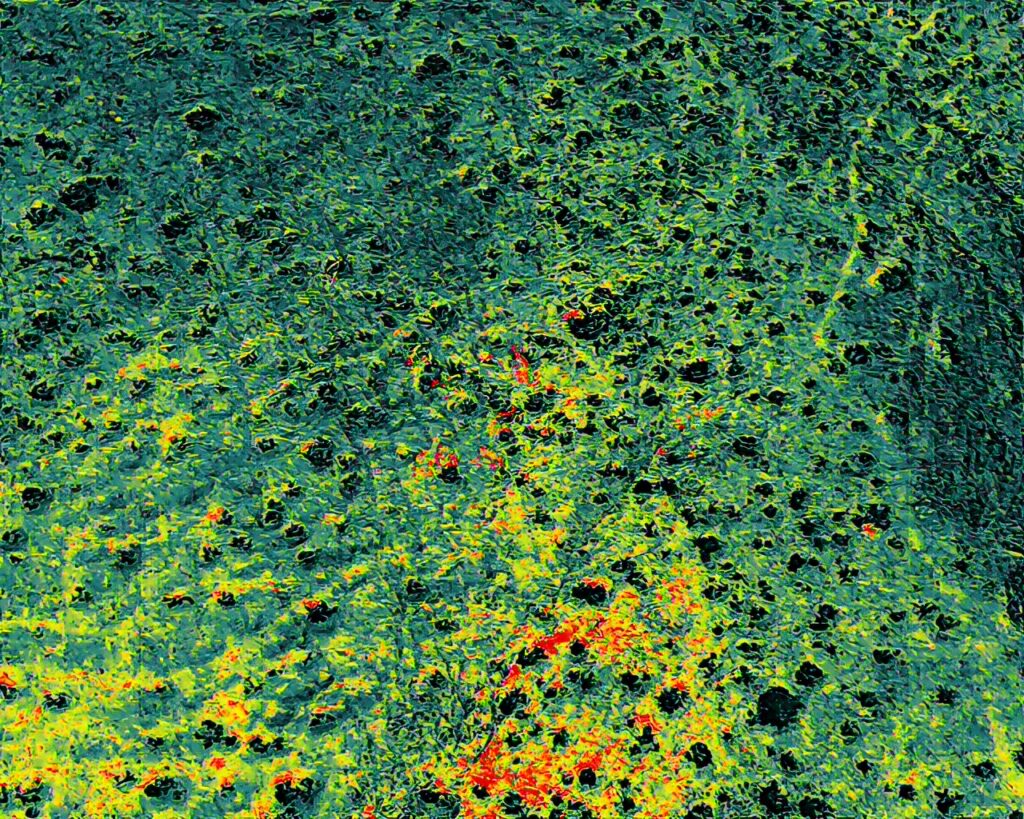
Thermal and Multispectral imaging
Energy System Diagnostics
Thermal imaging detects overheating, energy loss, or equipment faults in solar panels, power stations, and industrial setups, reducing failures and maintenance costs.
Building Inspection
Identify insulation gaps, water leaks, and energy inefficiencies to optimize energy consumption and maintain structural integrity
Agricultural Health Monitoring
Multispectral sensors detect crop stress, nutrient deficiencies, pests, and water needs, enabling precision agriculture and improved yields.
Environmental Monitoring
Monitor ecosystems, vegetation, water quality, and land degradation for conservation and sustainable resource management.
Preventive Action Insights
Processed thermal and multispectral data provide actionable insights to prevent issues proactively, such as scheduling irrigation or maintenance.
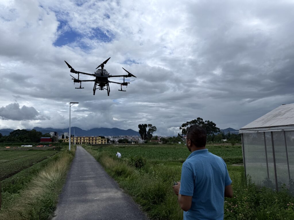
Drone-Based Spraying & Spreading
Precision Fertilizer Application
Drones apply fertilizers accurately and uniformly, optimizing crop nutrition while reducing soil degradation.
Pesticide & Herbicide Spraying
Targeted spraying minimizes human exposure and ensures effective pest control, while reducing chemical runoff.
Seed Spreading
Efficiently disperse seeds for reforestation, pasture regeneration, or remote farmland, promoting uniform growth.
Reduced Environmental Impact
Controlled application prevents soil and water contamination, supporting sustainable agriculture.
Operational Efficiency
Rapid aerial spraying saves labor, time, and improves coverage consistency for commercial farms, plantations, and government programs.
For Booking Agricultural Drone Service Click the link below:
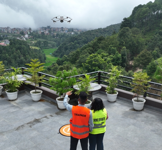
Drone Training & Capacity Building
UAV Operation Training
Hands-on instruction for safe drone operation, flight planning, obstacle avoidance, and emergency handling.
Data Processing & Analysis
Training on converting raw drone data into maps, 3D models, orthomosaics, and volumetric analyses.
GIS & Spatial Mapping
Teach integration of drone data into GIS platforms, spatial analysis, thematic mapping, and visualization.
Safety & Regulatory Compliance
Comprehensive training on national regulations, airspace restrictions, and operational safety.
Customized Organizational Programs
Tailored programs for government, corporate, and academic institutions, building local expertise and sustainable drone capacity.
For professional drone training Click the link below:
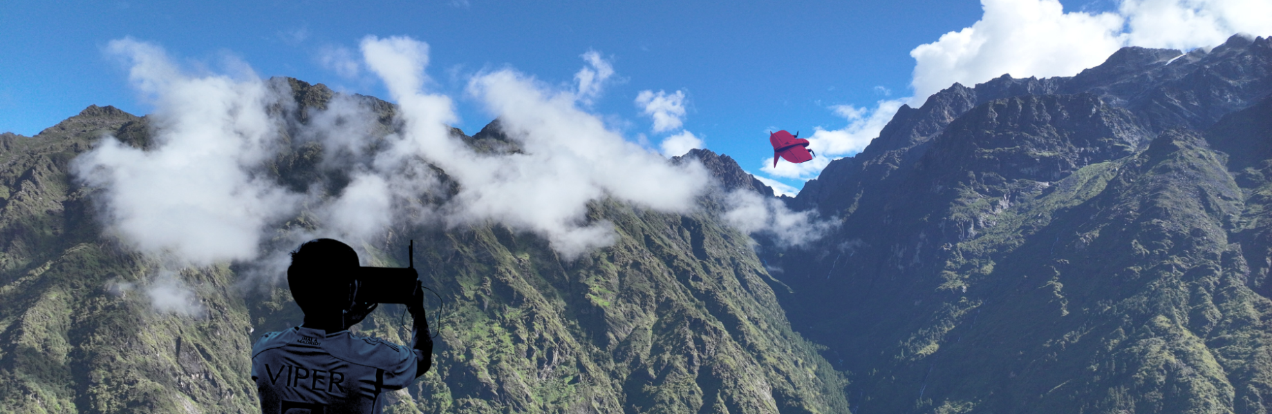
Drone-Based Photography & Videography
Aerial Project Documentation
High-resolution imagery and videos of construction sites, infrastructure, or environmental areas for monitoring and record-keeping.
Marketing & Promotional Content
Professional visuals for tourism, real estate, and corporate campaigns, enhancing branding and engagement.
Inspection & Survey Support
Visual data complements inspections and surveys, providing detailed perspectives for evaluation and reporting.
Event Coverage
Capture conferences, field activities, or special events from unique aerial perspectives for media or stakeholder engagement.
Storytelling & Visual Communication
Create compelling narratives through aerial imagery, helping clients communicate achievements, research, or conservation efforts effectively.