Media Type: Blogs
Blogs & Media
Preserving Heritage Sites- How Drones Can Help
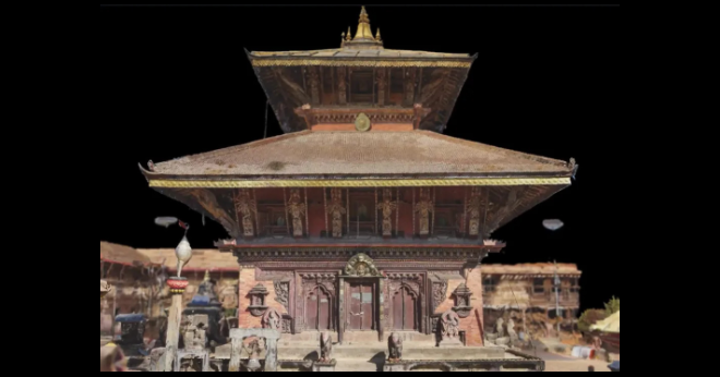
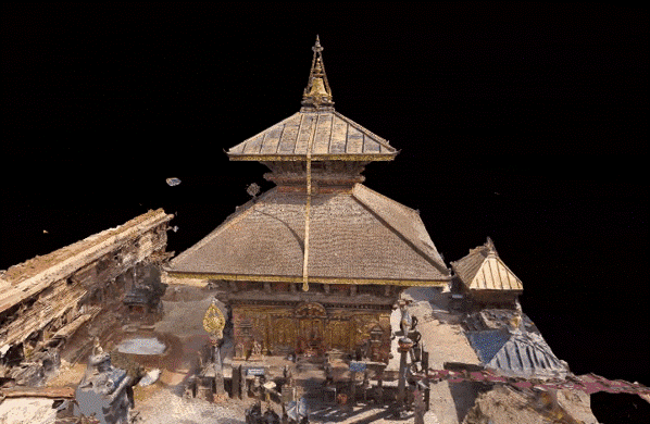
Nepal, a country steeped in history and culture, boasts a wealth of architectural, religious, and cultural heritage. From ancient temples to centuries-old palaces, preserving these invaluable assets is crucial to understanding Nepal’s rich tapestry of tradition and legacy. Drones are revolutionizing heritage preservation in the world, offering innovative solutions to inspect and archive cultural and historical landmarks.3D Model of Changunarayan Temple: Our Conservation Initiative in Collaboration with Skydio and Nepal Flying Labs

Preservation Matters: Understanding the Need
Nepal's diverse cultural heritage reflects the nation's vibrant history and beliefs. However, urbanization, natural calamities, and neglect pose significant threats to these historical treasures. Erosion, earthquakes, rapid development, and climate change can lead to the degradation of these vital landmarks.

In the critical task of restoring and preserving Nepal's invaluable heritage, the challenge is mainly exacerbated by the unavailability of comprehensive documentation and archives for the significant structures and sites, particularly after the earthquake of April 2015.
The devastating earthquake further emphasized the significant need for proper documentation and preservation measures.

Drone technology emerges as a crucial solution, offering powerful solutions to bridge this gap by providing intricate and accurate visual and spatial information essential for informed restoration strategies.
How Can Drones Help Safeguard Heritage
Equipped with high-resolution cameras and advanced sensors, drones play a pivotal role in the preservation of Nepal’s cultural and historical heritage.
1. Detailed Imaging: Drones capture high-definition images, facilitating the creation of accurate 3D models and digital representations of heritage sites, ensuring precise documentation.
2. Efficient Mapping and Surveying: Drones swiftly map expansive heritage areas, aiding in site analysis, feature detection, and precise measurements, providing critical data for preservationists.
3. Remote Sensing and Analysis: Advanced sensors on drones can monitor changes in topography, vegetation, and structures, offering valuable insights for preservation planning and disaster risk reduction.
4. Monitoring and Documentation: Drones enable ongoing monitoring of heritage sites, allowing experts to track changes over time, assess structural integrity, and implement timely conservation measures.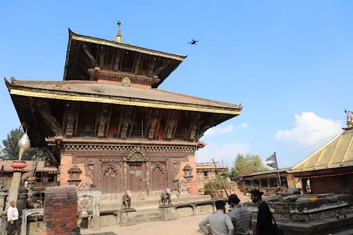
Skydio Drone flying over Changunarayan Temple for 3D Scanning

Sample of Details Captured in 3D Model
At Geovation Nepal, we are committed to finding innovative ways to preserve our heritage. Through drone technology, we are stepping towards offering comprehensive solutions for heritage inspection, documentation, and conservation as drones can revolutionize the way we protect and celebrate our rich cultural legacy.

Keep in touch with us as we explore how drones can aid in the preservation of Nepal's cultural and historical heritage.

Let's work together to safeguard countries' past, celebrating the unique stories that have shaped this magnificent nation for generations to come.
CONTACT US:
Phone: 01-5914432 || Email: info.geovationnepal@gmail.com || Location: Baluwatar, Kathmandu
Blogs & Media
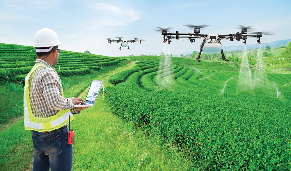
Prospective Avenues for Precision-Ag in Nepal !!
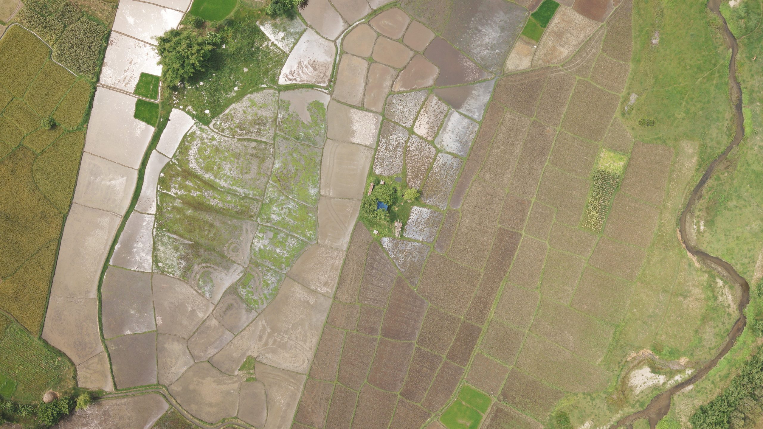
Due to unprecedented climate change resulting from rapid population growth, uncontrolled pollution, and increased food scarcity, the demand for climate-smart agricultural practices has grown worldwide. Many developed regions and African countries have been actively experimenting with and validating such practices. Simultaneously, precision agriculture, utilizing drone technology, is also advancing. Precision agriculture has gained global recognition, and in Nepal, some organizations have started investigating its feasibility.
Undoubtedly, implementing precision agriculture in Nepal presents challenges due to the highly fragmented arable land; however, we need to continuously seek for suitable options and alternatives. Land fragmentation presents various challenges when applying the principles of precision agriculture in Nepalese farms, particularly those primarily dedicated to the cultivation of rice and wheat, which are cereal crops. However, the hurdles may not be as significant when it comes to cash crops like sugarcane and tea due to their extensive cultivation areas.
The cultivation of sugarcane and tea holds promising prospects for precision agriculture for several reasons:
Large Cultivated Areas: Sugarcane and tea are typically grown on extensive agricultural lands. This minimizes the risks associated with fragmented lands and the vast acreage involved makes it practical to implement precision agriculture technologies, including drones, for monitoring and managing these crops efficiently.
Variable Growth Patterns: Both sugarcane and tea exhibit variable growth patterns within their plantations. Precision agriculture can help identify and address variations in growth, health, and yield, enabling farmers to optimize their resources and maximize productivity.
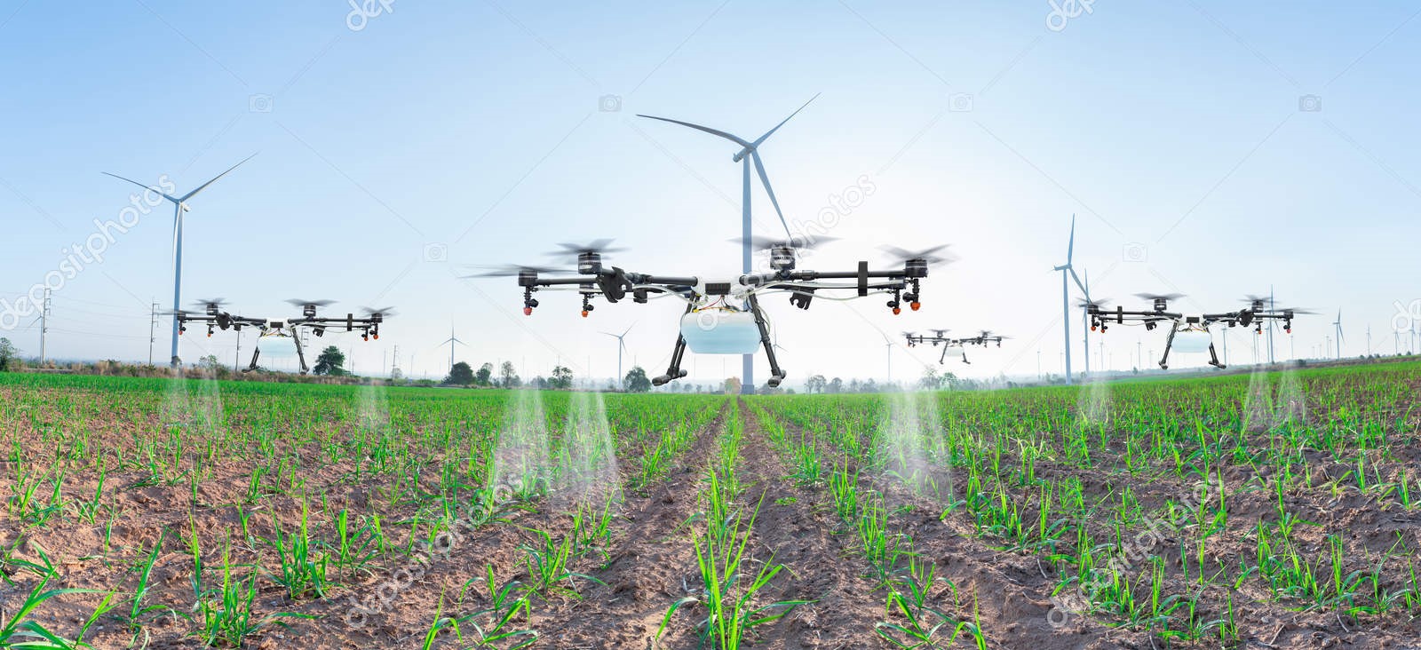
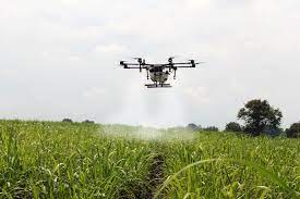
Resource Optimization and cost Reduction: Drones equipped with remote sensing technologies can assess the health and nutritional needs of sugarcane and tea crops. This information allows farmers to apply fertilizers, pesticides, and water precisely where they are needed, reducing waste and improving resource efficiency. Drones change all this, supported by geospatial data analytic software and ability to communicate with experts remotely. They also augment or reduce the need for workers in the field, responsible for walkabout scouting, inspection, and surveillance.
Pest and Disease Management: Unfavorable climate has affected tea and sugarcane production all over the country. On the other hand, one of the surveys has revealed that 40% of tea farmers applied pesticides ten times or more in one crop cycle. In these cases, drones can perform regular aerial surveys of sugarcane and tea fields, enabling early detection of pests and diseases. Timely and appropriate intervention can prevent the spread of these issues and minimize crop damage.
Yield Prediction: Government data shows that sugarcane production decreased by more than 305,000 metric tons in the last three years while output from tea has also been decreasing each passing year for lack of fertilisers. Precision agriculture, combined with data analytics, can provide valuable insights into expected crop yields. This information aids in better planning, forecasting, and marketing of sugarcane and tea products.
Environmental Sustainability: Precision agriculture practices, such as targeted application of inputs, contribute to reduced environmental impact by minimizing chemical runoff and conserving resources. This promotes environmental sustainability in both tea and sugarcane farming through early disease and pest detection using drones, minimizing the use of harmful chemicals and protecting the delicate ecosystem of the region.
Market Competitiveness: Among myriad gnawing problems, lack of certification and branding, organic tea of Nepal is not able to enter the international market and command premium prices. In case of sugarcane, the quality of sugarcane is also low in Nepal which is ~ 9% compared to the world average of 12 to 14 %. Implementing modern agricultural technologies like precision agriculture can enhance the competitiveness of sugarcane and tea products in both domestic and international markets.
In conclusion, precision agriculture offers a bright future for the cultivation of sugarcane and tea by providing tools and techniques to enhance productivity, reduce costs, and promote sustainability in these vital agricultural sectors. Furthermore, through the utilization of drones, GPS technology, and sensors in the context of tea and sugarcane, we can gather valuable insights into the challenges, deficiencies, potential opportunities, and outlook for extending the concept of precision agriculture to other crops.
Blogs & Media
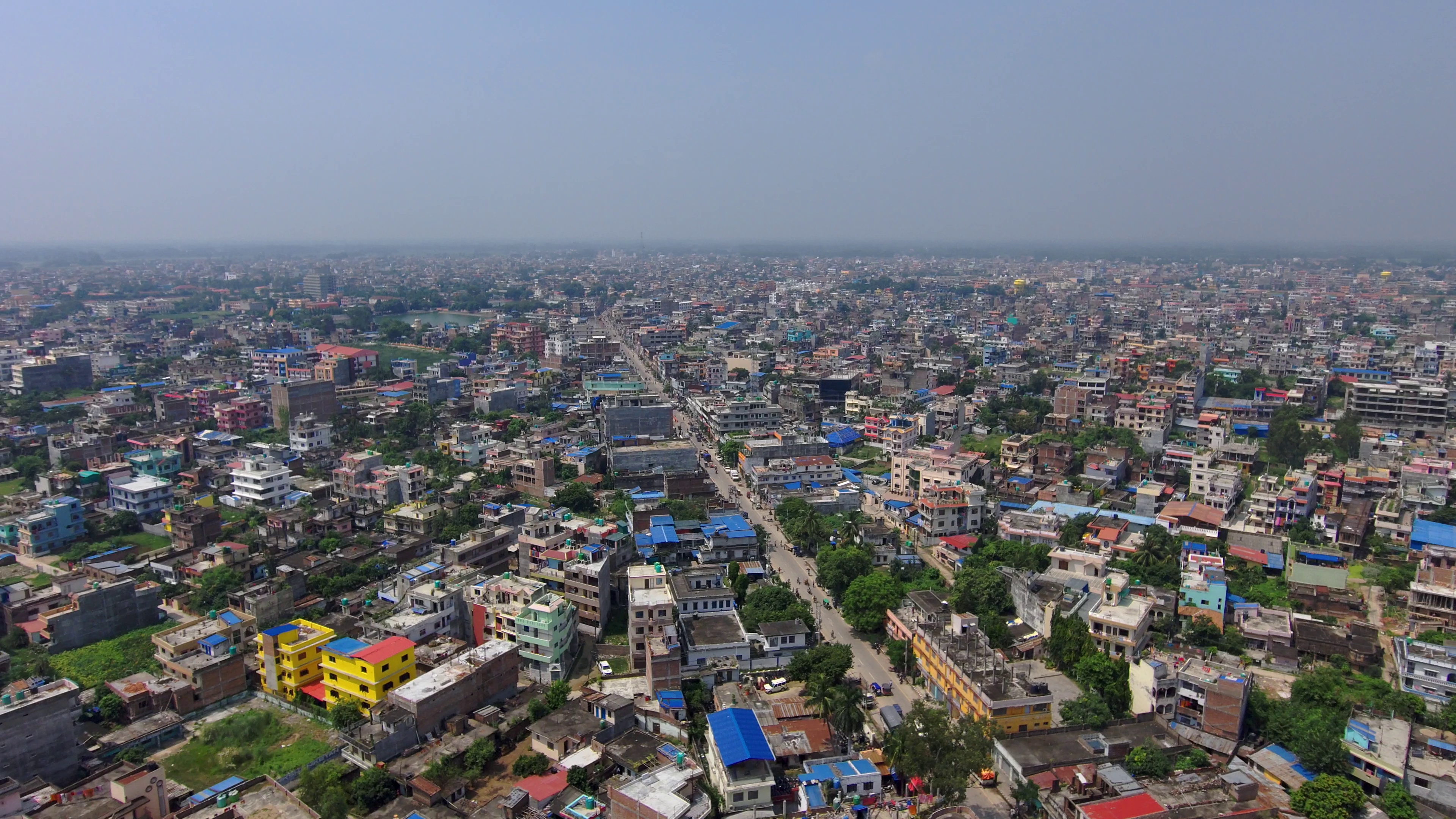
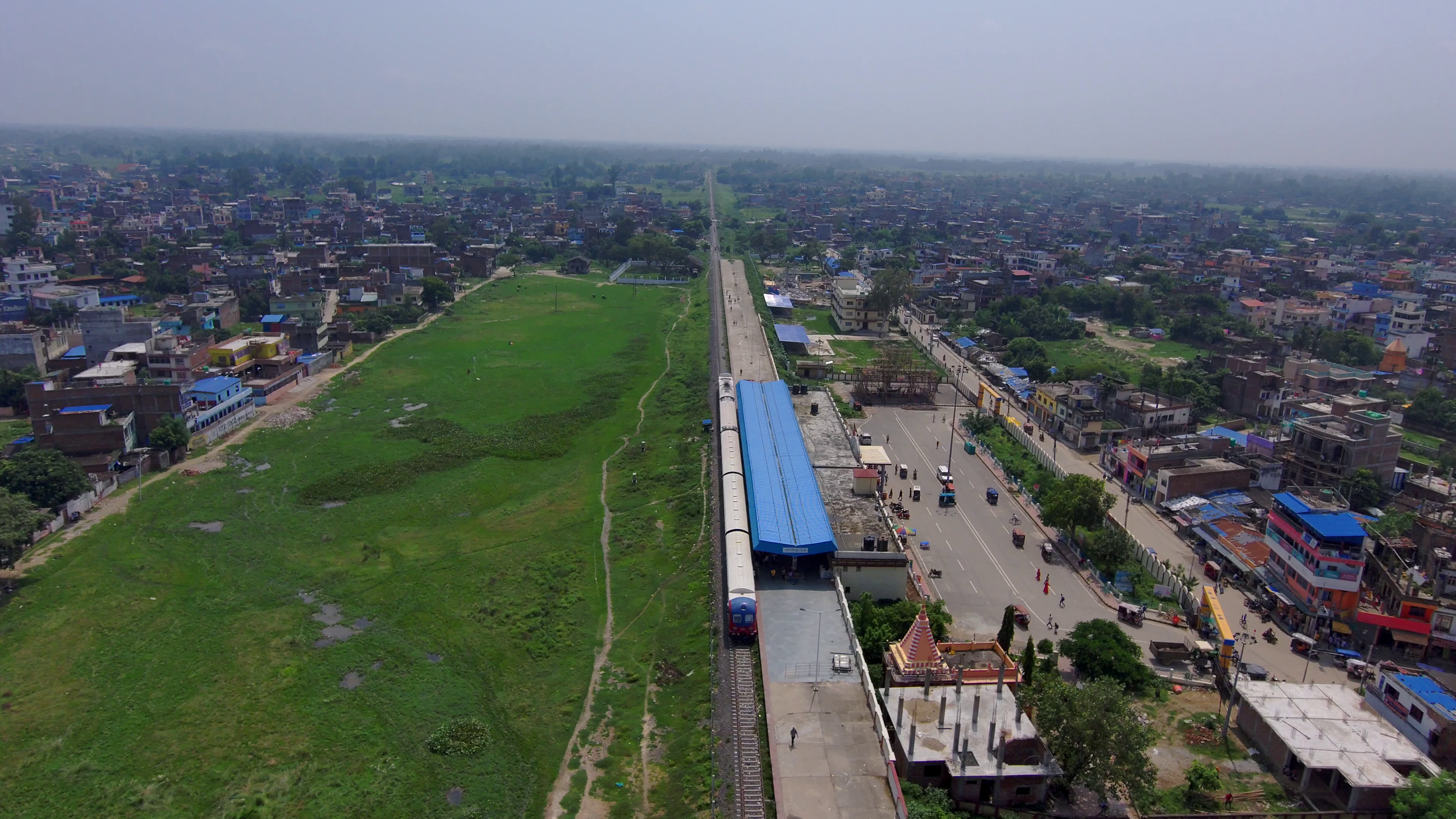
Drone Survey and Mapping; Janakpur Sub-Metro
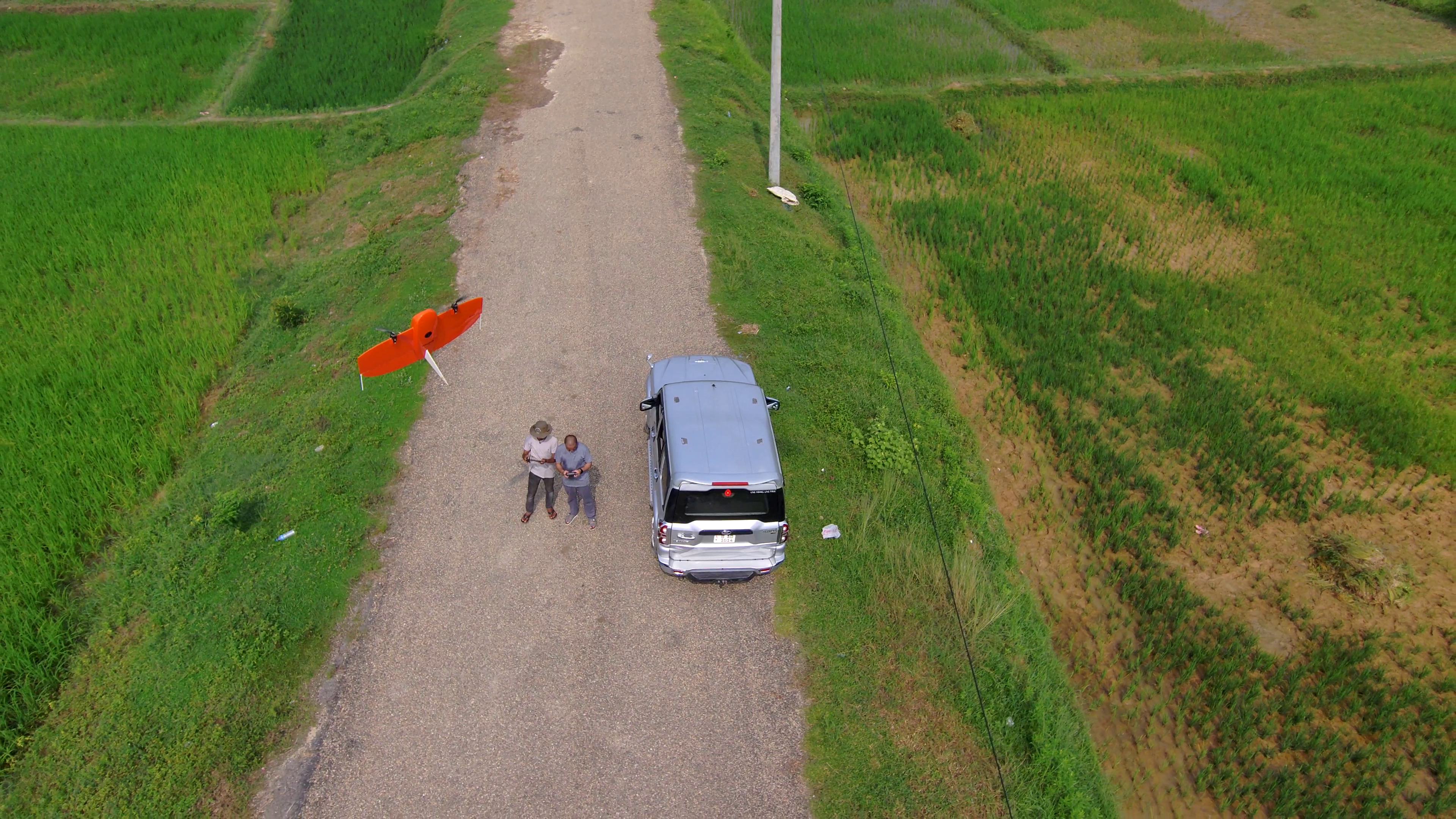
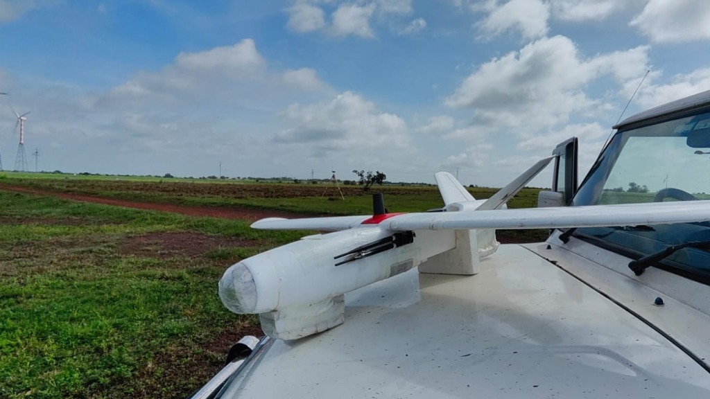
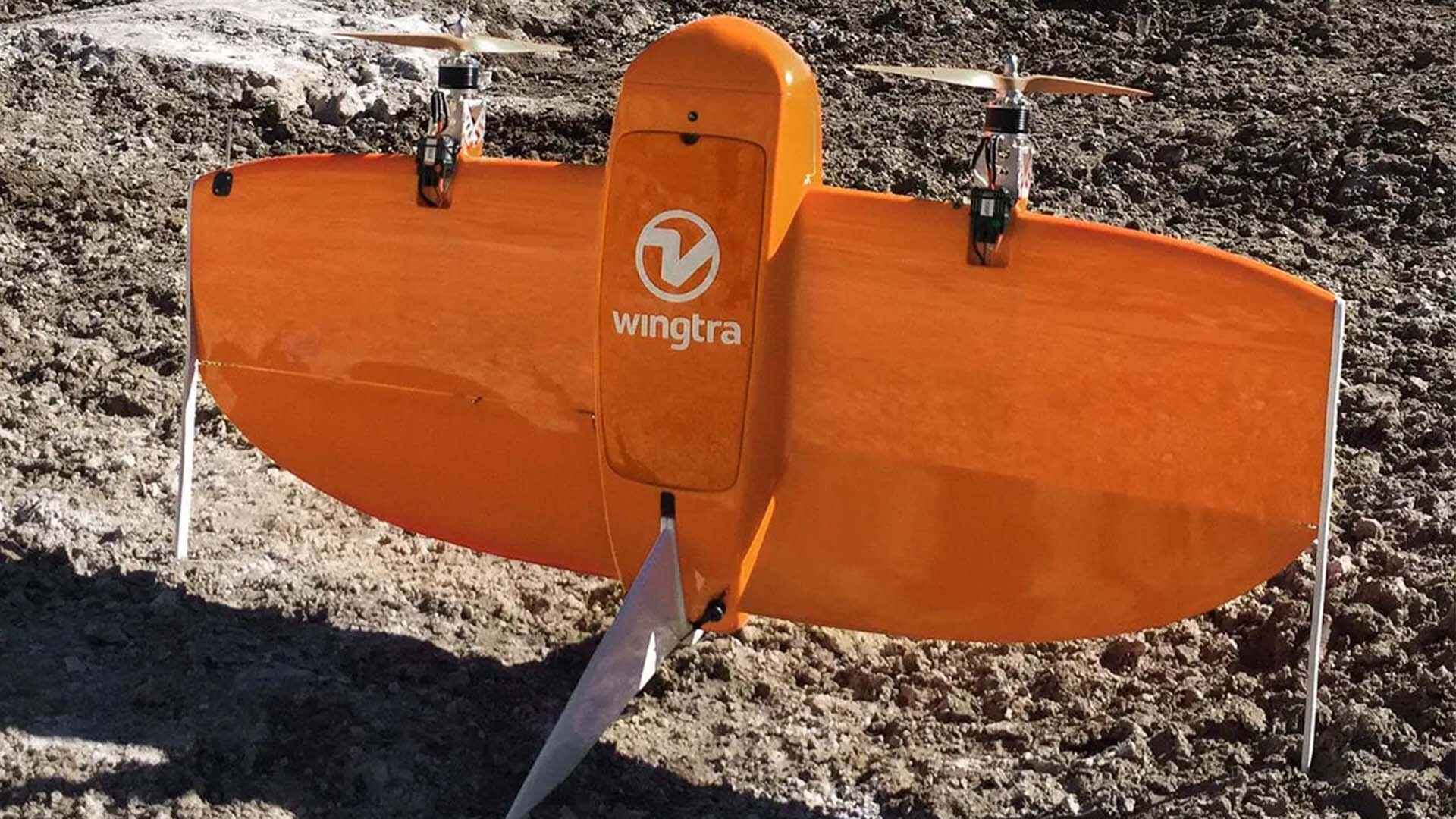
Nepal, renowned for its diverse landscapes and unique geographical features, offers a multitude of opportunities and challenges for geospatial analysis. As a drone-focused geospatial service provider based in Nepal, Geovation Nepal recently completed a remarkable drone survey covering the entire Janakpur sub-metropolitan city, an expansive area of over 90 square kilometers. This significant endeavor was made possible through the utilization of cutting-edge technology, specifically the Wingtra One Gen II drone equipped with a high-resolution mapping camera.
Our Hardware: Wingtra One Gen II
The selection of the Wingtra One Gen II, a state-of-the-art drone equipped with a high-resolution mapping camera, proved to be instrumental in achieving the survey objectives swiftly and accurately. The advanced capabilities of this drone allowed us to cover an extensive area in significantly less time while ensuring the necessary precision and detail. This technology enabled us to efficiently manage the survey despite the sheer scale and expanse of the region.
Overcoming Challenges
Conducting a drone survey over an area as vast as Janakpur, while not particularly challenging in terms of topography, presented logistical hurdles. The sheer size of the area, coupled with the need to navigate through restricted airspace due to the proximity of an airport, demanded meticulous planning and coordination. Additionally, ensuring optimal drone operations amidst the region’s relatively hot temperatures required careful attention and adaptation.
However, Geovation Nepal rose to the occasion, leveraging its expertise and dedicated resources. Our team of skilled professionals demonstrated resilience and proficiency in managing and mitigating the challenges encountered during the survey. The successful completion of the survey within the stipulated timeframe stands as a testament to our commitment to delivering on our promises.
Leveraging Drone Technology for Greater Impact
The extensive imagery and data collected during the survey are pivotal in generating valuable geospatial products. These products, currently under development, will serve as essential tools for urban planning, land management, infrastructure planning, and disaster preparedness within the surveyed area. This highlights the true potential and impact of drone technology in augmenting the understanding and development of the area while sustainably managing its available resources.

Choose Geovation Nepal for Your Aerial Imaging Needs
At Geovation Nepal, we are dedicated to providing efficient and accurate geospatial solutions tailored to your needs. If you require aerial imaging services for your projects, be it land surveying, infrastructure planning, environment and agriculture monitoring, or any other application, we have the expertise and technology to deliver the required results.
Contact us today and let us help you achieve your geospatial objectives with precision and efficiency. Together, we can revolutionize the way we perceive and utilize geographical data, ultimately contributing to a more informed and sustainable future.
Blogs & Media
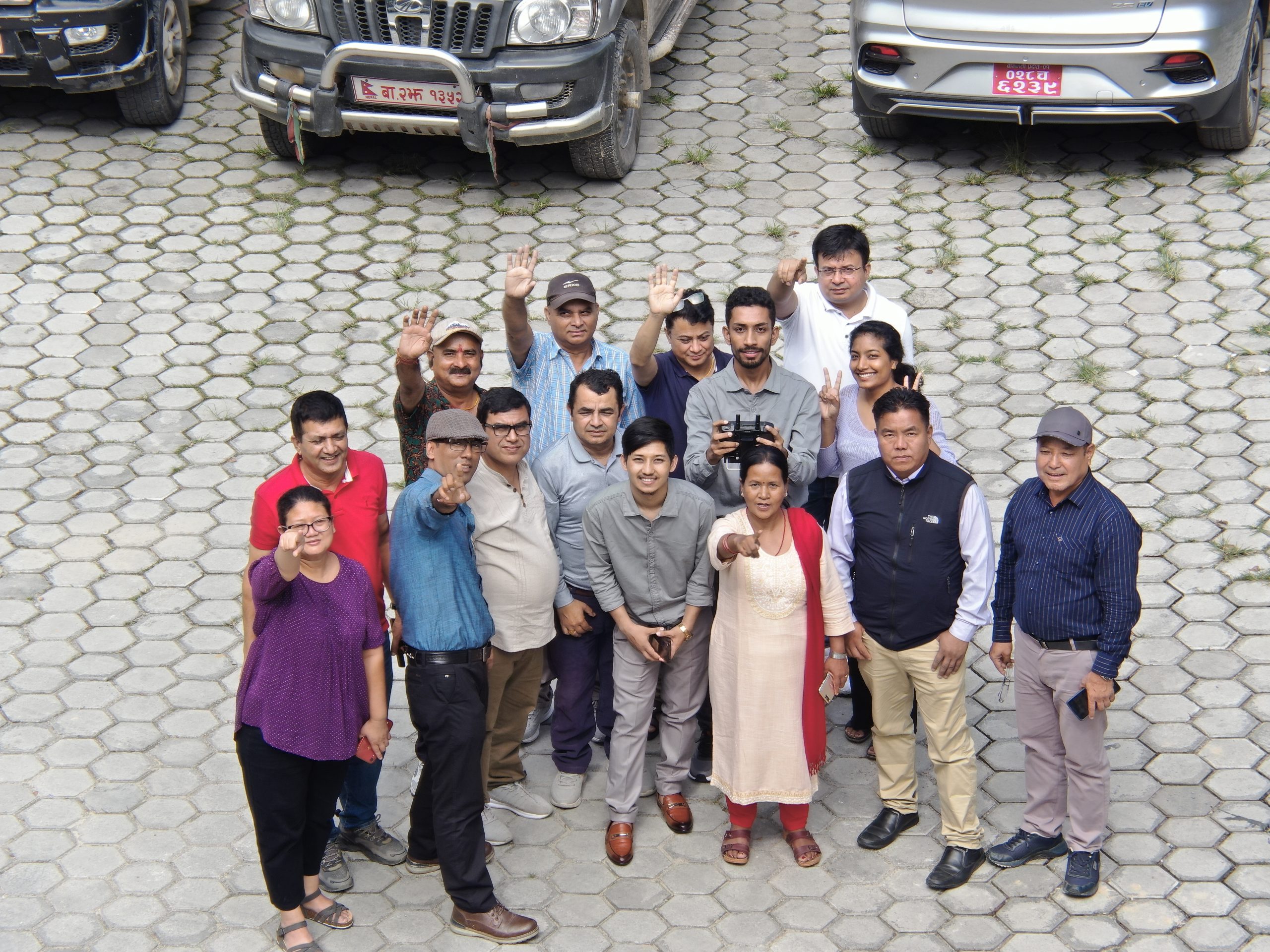
Multi-Theme Trainings at Geovation Nepal
Over the past few years of establishment, Geovation Nepal has achieved several milestones in accomplishing multiple surveying and mapping projects, alongside delivering multiple training programs in collaboration with prestigious and esteemed organizations from both government and non-government sectors including Nepal police ADB, WRRDC, Surya Nepal and NAXA. Similarly, during the second week of this August, we at Geovation Nepal got an overwhelming opportunity to organize training for DCRL (Developing Climate Resilient Livelihood in a vulnerable watershed in Nepal)/UNDP on the theme “Drone Application and GIS based Image Processing in Integrated Watershed Management (IWM)”. DCRL has a major focus on safeguarding vulnerable communities and their assets from climate change-induced disasters by applying a long-term, multi-hazard approach with a particular stewardship role for women and marginalized communities.DCRL has been actively conducting projects related related to IWM. Basically, Integrated Watershed Management (IWM) is a holistic and integrated approach for sustainable management of a watershed area. This particular workshop was organized for senior personnel of the DCRL/UNDP in Dhulikhel resort for five days from August 10-15. Afew months back, a Geovation Nepal team conducted a drones for Agriculture pilot study over a rice field at Belbari, Biratnagar. The team captured high resolution multispectral images of the rice field and processed those images to generate plant health maps and also carried out estimation of crop yields using GIS. While this endeavor was conducted as a pilot study, it ushered in new possibilities for both research as well as training in a new domain such as Agriculture.Furthermore, at present, the technical team at Geovation Nepal is leading all field based work and conducting drone operations to support the field based household numbering in Janakpurdham Sub Metropolitan city. Different applications of drone technology as mentioned above underscores the growing demand for drones across various sectors, driven by an increasing awareness among individuals and organizations regarding regarding the significance of moden geospatial tools and technologies in diverse aspects of development.
Development becomes magical when the people are educated and trained well. So, conceiving this fact and considering the increased attraction of people towards drones, Geovation Nepal has designed several training courses for drone enthusiasts. The main aim behind designing these courses is to train our immediate and future generations on the importance and application of modern geospatial tools and technologies. Generally, Geovation Nepal does ground based as well as drone-based aerial based surveying on different themes. The thematic areas of drone based aerial-training are as described below:
Disaster Management: Drone technology is revolutionizing disaster management by providing rapid, accurate, and cost-effective data collection capabilities. The training program on this theme empowers individuals and organizations to harness the potential of drones in mitigating risks and improving the risk efforts. Drones equipped with various sensors and cameras can rapidly collect crucial aerial data, allowing for more efficient disaster assessment, risk analysis, and response coordination.  This training prgram is designed to equip participants with the skills and knowledge required to effectively conduct drone-based aerial surveys for disaster management purposes. Participants will gain hands-on experience in planning, executing, and analyzing drone missions for disaster assessment and response.
Agriculture and Environment conservation: There has been increasing use cases of drones in agriculture and environment conservation. So, training course related to this theme empowers participants with the essential knowledge and practical skills required to leverage drone technology effectively in the fields of agriculture and environmental conservation. 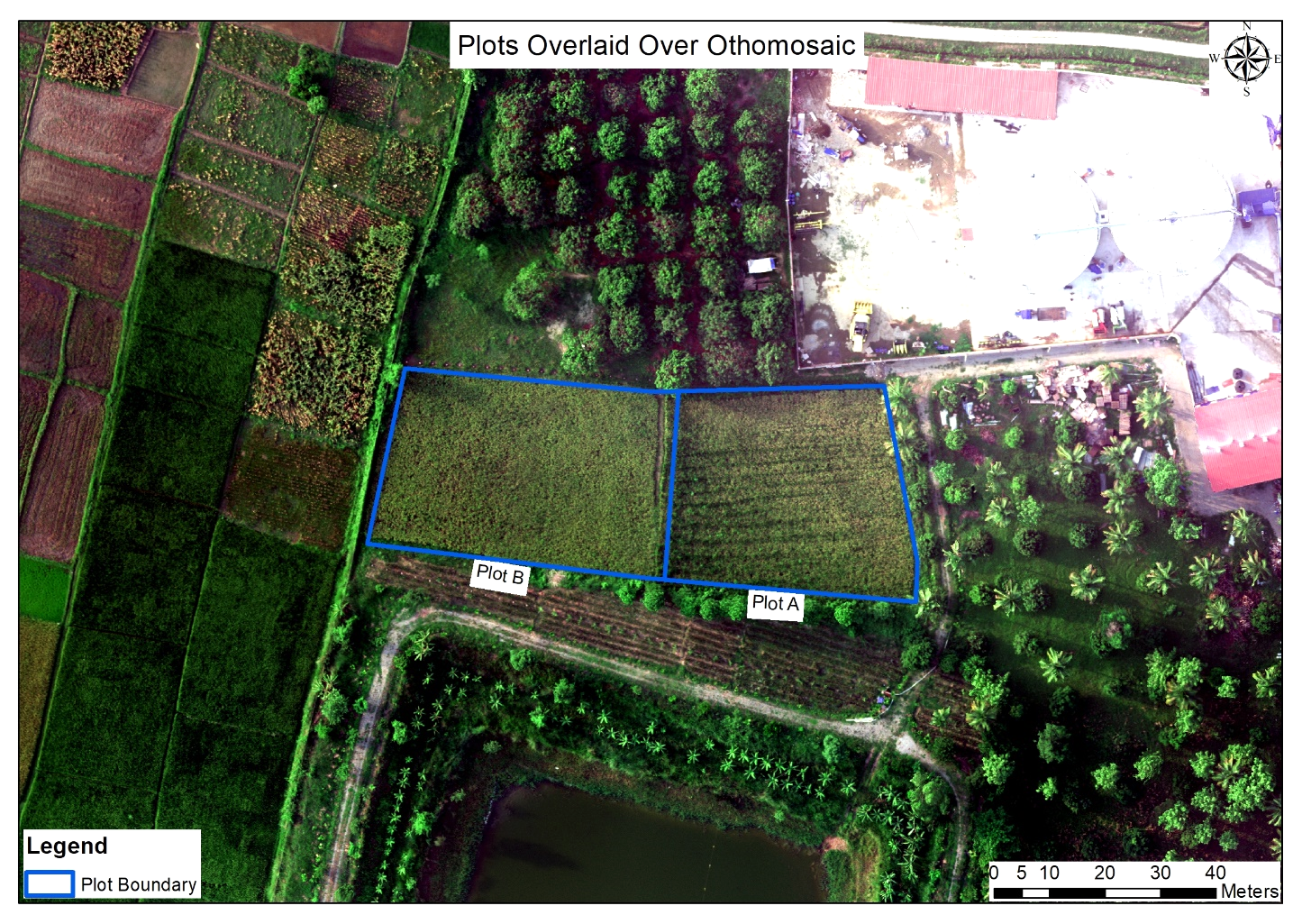 Over the course of this immersive training, participants will delve into the world of drone technology, from understanding drone components and regulations to mastering mission planning and data collection techniques. Through case studies and practical exercises, we explore applications in crop health assessment, environmental mapping, and monitoring.
Drone photo and videography: Drone technology has been seamlessly integrated into photo and videography, these days. So, one of trainings course is specialized for drone photo and videography. At the end of this course, students learn not only the technical aspects of operating drones but also the art of composition, framing, and storytelling from elevated viewpoints. 
 As part of their curriculum, students develop proficiency in post-production techniques, ensuring they can refine and enhance their captured content. Whether focusing on cinematic storytelling or specialized applications like mapping, drone training equips individuals with a diverse skill set that can be tailored to various industries.
Image processing: Training course in the use of drone image processing equips individuals with the knowledge and practical skills essential for harnessing the power of drone-captured data. This structured curriculum begins with an introduction to drone technology, including operation and regulations, and progresses into the intricacies of data collection, preprocessing, and enhancement. 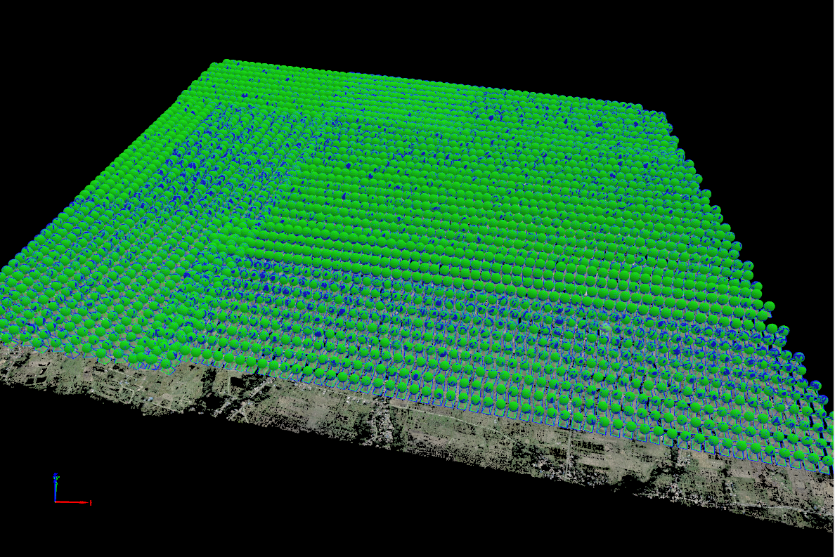 Participants learn to wield specialized image processing software and programming languages, enabling them to manipulate and analyze aerial imagery effectively. The training extends into geospatial analysis, machine learning integration and 3D modeling, enabling graduates to tackle diverse applications in fields such as agriculture, environmental science, and infrastructure inspection.
Map making and analysis with GIS: The training course on GIS map making empowers individuals with the tools and knowledge to effectively harness the power of spatial data. This course covers a wide range topics, from fundamental GIS concepts to advanced spatial analysis techniques. Participants learn to collect, manage, visualize, and analyze geospatial data, enabling them to create informative and visually compelling maps. 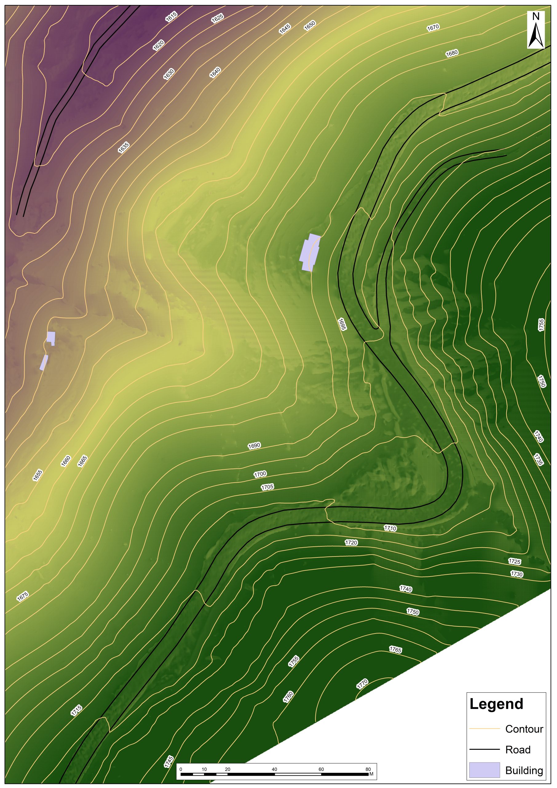 With a focus on practical applications, students engage in real-world projects that span fields such as urban planning, agriculture/environmental management, and disaster response. Ultimately, GIS training equips individuals with the skills necessary to excel in a variety of professions where spatial analysis and mapping play a crucial role, from urban planning to natural resource management.
All in all, Geovation Nepal intends to disseminate GIS and drone knowledge and their application in diverse fields of development. Moreover, there are still the domains to explore and expand the applicability of geospatial tools and technologies in Nepal.
Blogs & Media
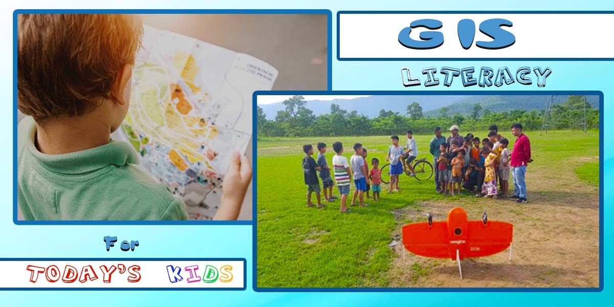
GIS Literacy for Today’s Kids!
The current generation of Kids is drenched in the rapid advancement of technology, readily embracing new tools and devices, their upgraded versions, and engaging smart games like Minecraft, Mario Kart 8, and GTA Vice City. Through their interaction with these intelligent tools, they unknowingly develop a range of essential life skills.
In a similar vein, the Geographic Information System (GIS), as widely accepted frontier in technology can captivate young minds as a fascinating tool.
The applications of GIS spread across numerous fields, making it imperative for today’s children to grasp its significance and immense potential for the future. The demand for GIS functionality is constantly increasing, urging for faster, cost-effective, and more intricate capabilities. Anticipating these development and future digital environment, it becomes highly advantageous and desirable to introduce children to the realm of GIS through playful but interactive courses, trainings, and workshops.
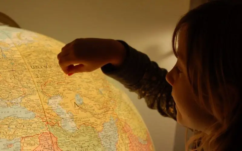
These kinds of engaging sessions foster them in cultivating their understanding of geography and spatial information. Besides, colourful and cartographic-based games could be developed that stimulates their brain activity.
With the facility of placing query in such applications, children can play with queries such as calculating distance to best friends’ home, identifying nearby hospitals and playgrounds, determining dangerous/no-entry zones for children and locating natural resources like rivers around them.
Engaging in such activities, GIS plays a pivotal role in honing problem-solving skills in children, fostering critical thinking as they analyse geographic data, discern patterns, and make well-informed decisions.
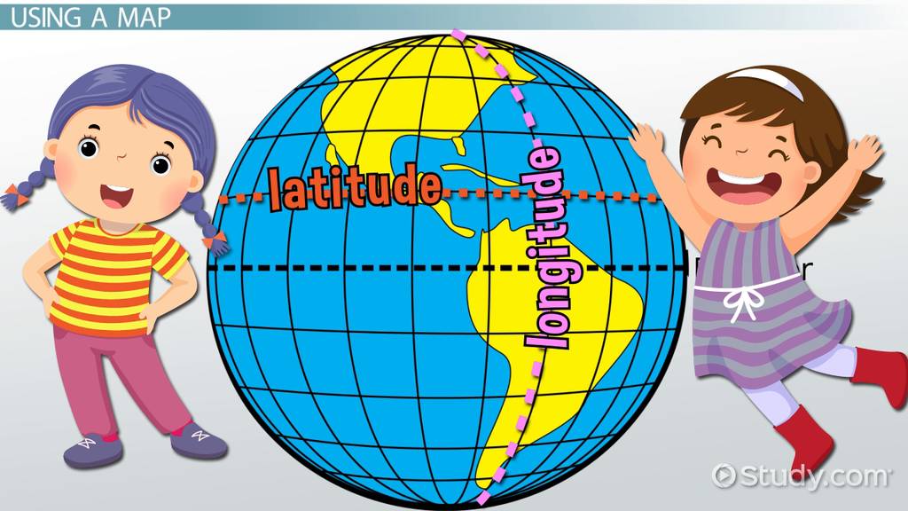
With its integration of various disciplines like geography, science, mathematics, and social studies, GIS enables children to perceive the interconnectedness of different subjects, promoting a holistic approach to learning.By acquainting kids with GIS, they gain familiarity with cutting-edge technology and data analysis tools. They delve into the realms of digital mapping, data visualization, and geospatial analysis, indispensable competencies in the modern world. The applications of GIS are boundless, encompassing fields such as health, city governance, transportation, urban planning, business marketing, geology, disaster preparedness, social media, and environmental science.
A career in GIS holds promise for children who find passion in web applications and computer programming, as well as those drawn to the intricacies of mathematics and statistical analysis. It provides a unique opportunity for young minds to channel their passions into a field that continues to shape and transform how we perceive.

Thus, exposing children to GIS serves as a gateway to a world of limitless possibilities, cultivating their interests and preparing them for a future where technology and data are pivotal aspects of society’s progress.
Blogs & Media

“Burgeoning Significance of Drones”
The widespread intervention of drones into everyday life in almost every aspect is already well underway. At this stage of human civilization, the convenience offered by drones is becoming increasingly recognized and embraced. In the past, drones were primarily renowned for their involvement in warfare, acting as decoys, and deploying missiles against targets. However, their current roles have diversified significantly, encompassing various areas such as photography and videography, climate change monitoring, medical supply deliveries, disaster preparedness, yield forecasting, and resource optimization in agriculture. In fact, in all areas of life, there is an increasing rush for adopting drones/UAVs to make human lives comparatively more better.
Nowadays, aerial photography and videography have become more get-at-able not only to professional movie makers but also to everyday individuals, equipping people to reproduce mesmerizing moments and awe-inspiring views. The impact of drones on movie-making can be witnessed in films like “Skyfall” and “The Greatest Showman,” where drone shots have captivated audiences.
Similarly, in the realm of medical emergencies, the subsequent importance of drones became apparent during the COVID-19 pandemic. The global market for medical drones, valued at US$88.2 million in 2018, witnessed a remarkable increase in demand due to the outbreak of the coronavirus. Nations such as Rwanda, Ghana, and Tanzania embraced these technological marvels to carry out essential medical tasks like collecting blood samples and transporting vaccines and medical supplies.
Simultaneously, as we delve deeper into understanding the impact of climate change on the environment, advancements in robotics have made this exploration of climate change ensued impacts more cost-effective and less labor-intensive. Climate change being one of the challenging issues of the world, drones have been used for monitoring and evaluating its effects. For instance, mosses in Antarctica have been identified as a vital climate change indicator, and ongoing research with drones is currently investigating their impacts.
On the other hand, Drones have brought comfort to the agricultural sector by optimizing farming practices. Precise monitoring of crops, livestock, and land conditions enables farmers to increase yields and reduce resource wastage. This leads to a more sustainable and reliable food supply, providing comfort to both producers and consumers.
UAVs are also found to be helpful in disaster preparedness, impacts minimization and immediate response which is another application of UAVs where the vast amount of different unmanned aerial vehicles can be exploited. In fact, drones are now standard for every WFP emergency response. During 2019, in Mozambique, two back-to-back cyclones affected human lives disastrously. With the help of drones, the damage was quite easily mapped and survivors were searched as soon as possible while freeing up helicopter pilots to conduct rescue and supply missions.
In more recent times, advancement among drone users has reached the next heights. After achieving the historic feat of delivering the world’s first pizza by drone from a New Zealand store in 2016, Domino’s is once again exploring the possibility of commercial drone delivery. They are currently testing “Domicopter” drones for pizza deliveries. Taco Bell is also in the midst of exploring the use of “Tacocopter” drones for their own purposes. Meanwhile, Amazon is diligently working on a fleet of delivery drones with the aim of revolutionizing the postal service. Federal Express is also dreaming of employing pilotless aerial and terrestrial drones for transporting goods more efficiently, economically, and safely compared to vehicles operated by humans.
All in all, versatility, efficiency, and diverse applications of drones make them invaluable tools capable of addressing various challenges in every aspect of human life.
Blogs & Media
3D Modeling: Creating A Digital Twin
3D modeling, the process of creating digital representations of three-dimensional objects also called a digital twin, has seen significant advancements with the rise of drone technology. Drones offer numerous advantages over traditional methods, enabling the capture of detailed images and generating 3D models quickly and efficiently. In this blog post, we will explore the step-by-step process of creating a 3D model using drones.
- Selecting the Right Drone: The initial step is selecting the appropriate drone for your specific needs. Consider factors such as the size and complexity of the object you wish to model, the required image resolution, and the drone’s flight time. For larger objects, opt for a drone equipped with a high-resolution camera and extended flight capabilities. Smaller objects may be captured using a compact drone with a lower-resolution camera.
- Capturing the Images: Once you have chosen the drone, the next stage involves capturing a series of images of the object you intend to model. These images should overlap to facilitate their stitching together into a cohesive 3D model. To achieve this, fly the drone in a grid pattern, circular pattern with oblique view over the object, ensuring comprehensive coverage from various angles. In addition, DSLR cameras, GoPro are also captured to create a more detailed output. However, the advancement in AI and their implementation in Drone technology, now drones are capable of identifying the object, its shape, size and overall architecture. Moreover the advancement in obstacle detection and avoidance technology drones have become more safer, reliable and unlock new possibilities in 3D modeling. These capabilities allow drones to create a dynamic flight route that enables drones to get close to the subject, detecting obstacles and gathering data of every hook and corner, helping to create more detailed models than ever.
- Processing the Images: The images captured by the drone and other devices must be processed using specialized 3D modeling software. These programs employ sophisticated algorithms to stitch the images together, creating an accurate and detailed 3D model of the object. Notable software options for image processing include Pix4D, DroneDeploy, and Agisoft Metashape.
- Creating the 3D Model: With the processed images, you can now proceed to generate the final 3D model. Utilize 3D modeling software or consider employing a 3D printing service for this purpose. The software enables you to create a digital model of the object, which can then be utilized for visualization, planning, game design or even 3D printing.
Drones have revolutionized the process of creating 3D models, providing efficient and precise data capture in previously inaccessible areas. With the ability to capture detailed imagery and generate 3D models swiftly, drones have opened up new possibilities in various industries. As drone technology continues to advance, we can anticipate further innovative applications for 3D modeling, further enhancing our ability to visualize and utilize three-dimensional data.
Blogs & Media
Drones For Agriculture
20th National Paddy Day: Climate resilient farmers’ friendly technology for increasing rice production
Nepal joyfully celebrates its 20th National Paddy Day today, Asar 15, which typically falls in late June or early July according to the Gregorian calendar. This year’s theme, “Climate resilient farmers’ friendly technology for increasing rice production,” highlights the importance of leveraging technology in agriculture. One such promising technology is the use of drones, which can significantly contribute to sustainable rice farming practices in Nepal.
Drones offer a range of applications in rice farming, including precise and efficient rice seedling planting, accurate application of pesticides and fertilizers, monitoring of fields for pests and diseases, and even streamlined harvesting processes. With every passing year, the effects of climate change and global warming pose challenges to food production. As an agricultural nation with limited fertile land, it becomes crucial for Nepal to adopt innovative technologies like drones to maximize agricultural productivity on every available piece of land.
By utilizing drones, Nepali farmers can witness several benefits. Firstly, it enables them to enhance rice production by improving the efficiency of planting, fertilization, and harvesting practices. Moreover, drone technology can reduce costs by minimizing labor requirements and optimizing resource utilization. Additionally, drones aid in maintaining crop quality by mitigating risks associated with pests, diseases, and crop damage. Ultimately, this technology promotes sustainable agriculture by reducing the dependence on pesticides and fertilizers, aligning with the goal of environmentally friendly farming practices.
Overall, the celebration of National Paddy Day in Nepal highlights the significance of embracing innovative technologies like drones to bolster rice production, ensure food security, and foster sustainable agricultural practices.
Blogs & Media
Drones for Surveying and Mapping
In recent years, drones have transcended their reputation as recreational gadgets and have emerged as powerful tools with immense potential across various sectors. One industry that has experienced a significant transformation due to drone technology is surveying and mapping. These unmanned aerial vehicles (UAVs) have revolutionized the way we collect geospatial data, create maps, and visualize terrain. Let’s understand the major outputs of drone surveying and mapping and their invaluable applications in this dynamic field.
1. 3D Models: Drones equipped with advanced sensors capture high-resolution images and generate detailed 3D models of the surveyed area. These models provide an immersive and accurate representation of the terrain, buildings, and infrastructure. 3D models enable surveyors to perform measurements, analyze volumetric, and conduct simulations, aiding in urban planning, construction projects, and land management.
2. Orthomosaic Images: Orthomosaics are highly precise, georeferenced aerial images stitched together to form a seamless, orthorectified map. These images offer an accurate representation of the surveyed area, accounting for distortions caused by topography and camera angles. Orthomosaic maps are indispensable in creating detailed base maps, monitoring land use changes, conducting environmental assessments and much more.
3. Digital Surface Models (DSMs): A Digital Surface Model represents the Earth’s surface, including natural features, buildings, vegetation, and man-made structures. By analyzing elevation data collected by drones, DSMs provide a comprehensive view of the terrain, enabling precise measurements of heights, slopes, and contours. This data is crucial for infrastructure planning, flood modeling, and forestry management.
4. Digital Terrain Models (DTMs): DTMs, also known as bare-earth models, focus on representing the ground surface without any vegetation or structures. By removing above-ground features, DTMs provide accurate elevation information essential for engineering projects, land development, and floodplain mapping. DTMs facilitate slope analysis, cut and fill calculations, and geological studies.
5. Google Tiles: Drones can capture imagery at high resolutions and generate Google Tiles, which are image tiles used in popular mapping platforms like Google Maps. These tiles enhance the visual representation of the surveyed area, improving navigation, and enabling users to explore detailed aerial views. Google Tiles find applications in real estate marketing, tourism, and urban planning.
Drones have revolutionized the surveying and mapping industry, offering unprecedented capabilities in data collection and analysis. The outputs generated by drone surveys provide invaluable information for urban planners, engineers, environmentalists, and land managers. By leveraging these outputs, professionals can make informed decisions, optimize resource allocation, and enhance the accuracy and efficiency of their projects. As drone technology continues to evolve, we can expect even more innovative applications and outputs that will shape the future of surveying and mapping, unlocking new possibilities in understanding and managing our ever-changing world.
Blogs & Media
UAV Permission and Flying Regulation in Nepal
UAVs (Unmanned Aerial Vehicles) or RPAs (Remotely Piloted Aircrafts) commonly known as drones, have become popular within the last few years. Generally, people consider a drone as a flying machine with a camera but, a typical drone consists of three main systems – A flight system, a sensor system, and a navigation system. The flight system determines the mode of operation of drones (Manual, semi-autonomous and autonomous), a sensor system handles the payload (camera, Li-DAR, Sonar) where as, navigation system (GPS, IMU,VPS) navigates the drone by identifying its position in the airspace.
In recent years, drones have been increasingly utilized in various industries and applications such as aerial photography, survey and mapping, search and rescue operations, wildlife monitoring, and humanitarian aid delivery. In the aftermath of the 2015 earthquake, drones were used for search and rescue operations and for collecting data for relief efforts. Since then, various international and local organizations have utilized drones for a wide range of purposes, such as monitoring the reconstruction of damaged buildings, mapping the affected areas, and delivering essential supplies to remote communities.
Hence to regulate and monitor drone operation in Nepal the Ministry of Home Affairs introduced “Drone Related Flight Work Plan 2072 B.S ” in the year 2072 BS and revised regulation in 2075 BS published as “Drone Related Flight Work Plan 2075 B.S”. The provided information on obtaining flight permission will be based on “Drone Related Flight Work Plan 2075 B.S”.
The Ministry of Home Affairs (MOHA), Ministry of Information and Communication (MOCIT) and Civil Aviation Authority Nepal (CAAN) are the main bodies of Government of Nepal for regulating UAV uses to ensure national security, public safety and prevent any misuse of UAV in Nepal.
- Ministry of Home Affairs (MOHA)
Drones were initially invented for the purpose of espionage and the delivery of explosive materials through the air, making them a technology of warfare. Due to this potential threat, the home ministry, which is responsible for the country’s security, aims to ensure that every flight of drones within Nepal’s borders does not pose a threat to national security. To that end, they are taking measures to regulate the use of drones within the country.
- Ministry of Information and Communication (MOCIT)
The Ministry of Information and Communication is tasked with overseeing the operating parameters of any communication medium, including radios, televisions, walkie-talkies, and other communication equipment. They are responsible for regulating the channels of communication, which includes drones and their communication equipment. To ensure the safe and responsible use of drones, the Ministry must regulate the communication channels used by these devices.
- Civil Aviation Authority Nepal (CAAN)
The Civil Aviation Authority of Nepal (CAAN) is responsible for managing and regulating air traffic in the country. Their main concern is the potential for drones to interfere with or collide with other aircraft. Unregulated drone operations and flights in sensitive areas are seen as posing a threat to security, weakening air safety, and violating personal privacy. As a result, the CAAN is implementing measures to control drone use in Nepal.
How to Secure Drone Permission ??
Let’s dive straight into it.
The government of Nepal has categorized the drones/ UAVs on the basis of their weight and created different sets of regulations for each category.
Table: Drone Classification based on weight with its risk stakes
| Drone Category | Category A | Category B | Category C | Category D |
| Weight | Up to 250 gm | Between 250 gm – 2 KG | Between 2 KG – 25 KG | Above 25 KG |
| Risk Stakes | Very Low Risk | Low Risk | Regulated, Low Risk | Regulated, High Risk |
| Examples | Autel Evo Nano, DJI Mini SE | DJI Phantom, DJI Mavic series | Wingtra One, DJI Matrice 300, DJI Inspire | Industrial Drones with heavy payloads, DJI AGRAS series |
- Register your Drone
First of all, you need a Unique Identification Number (UIN) before applying for a flight permission. You can get the UIN only after registration with CAAN. One can apply for his/her drone registration online.
You will require the following documents for drone registration:
- Citizenship/Passport (Incase of Individual)
- Organization Registration Certificate (Incase of consulting firm/company)
- Objectives of the Instrument
- Specification of the Drone and its Manual
- VAT Bill (if purchased in Nepal) or Customs Document (If purchased/brought from abroad)
Or , visit Flight Safety Standard Department (under the Civil Aviation Authority of Nepal) with one additional A fill up form which is located at Sinamangal, Kathmandu.
- Drone Flight Permission
If your drone falls under the category A and category B you must visit the District Administration Office in the district where you wish to fly drones. If your drone falls under the category C and category D you must obtain permission from MOHA, MOCIT and other concerned authorities depending on the purpose of flight. The following documents required to apply for drone flight permission:
- Drone Registration Certificate
- Drone specification
- Copy of citizenship/ Passport of drone pilot license, and CV
- Flight details such as purpose of flight, flight start date, flight end date, flight location with its boundary location.
- A drone pilot’s commitment to abide by the rules, in writing.
Note 1: Universities and research institutions with registered category A and category B drones are not required to have a drone flight permit for flying within their own facilities. Having said that, they cannot fly drones above 200 ft AGL and will be fully responsible for their actions.
Note 2: If your drone falls under the category A and you want to fly under 50 ft AGL (Above Ground Level) you don’t have to take permission and fly drones by informing local police taking full responsibility for your action.
Note 3: For foreigners, one must pay customs fees and obtain custom clearance documents. Then S/He can must obtain clearance from Ministry of tourism, MOHA, CAAN and other concerned authorities such as National Parks administration office one wants to fly within that area.
The obtained flight permission will be valid for only three months and can be extended up to 3 months if necessary.
Restricted areas
The new rule related to drone operation has categorized the following regions as the restricted area for drone operations:
- All drone activity must be avoided in an area within 5 km of the airport.
- A 5 km distance from the international boundary must be kept clear of drones.
- Drones must not be flown within a 1 km radius of religious, heritage, and sacred sites.
- The offices and residences of the President, Vice-President, Prime Minister, and other VIPs must have a no-fly zone of 1 km radius.
- Military and safety offices must have a no-fly zone of 1 km, while other safety departments must have a 500m no-fly zone.
- Conservation areas and mines must not be flown over by drones.
- Conflict and war zones must be avoided by drone flights.
- Other areas with restrictions as specified by provincial or local governments must also not be flown over by drones.
Other restriction areas as stated by the provincial or local governments.