Portfolio Type: Highlights
Portfolio
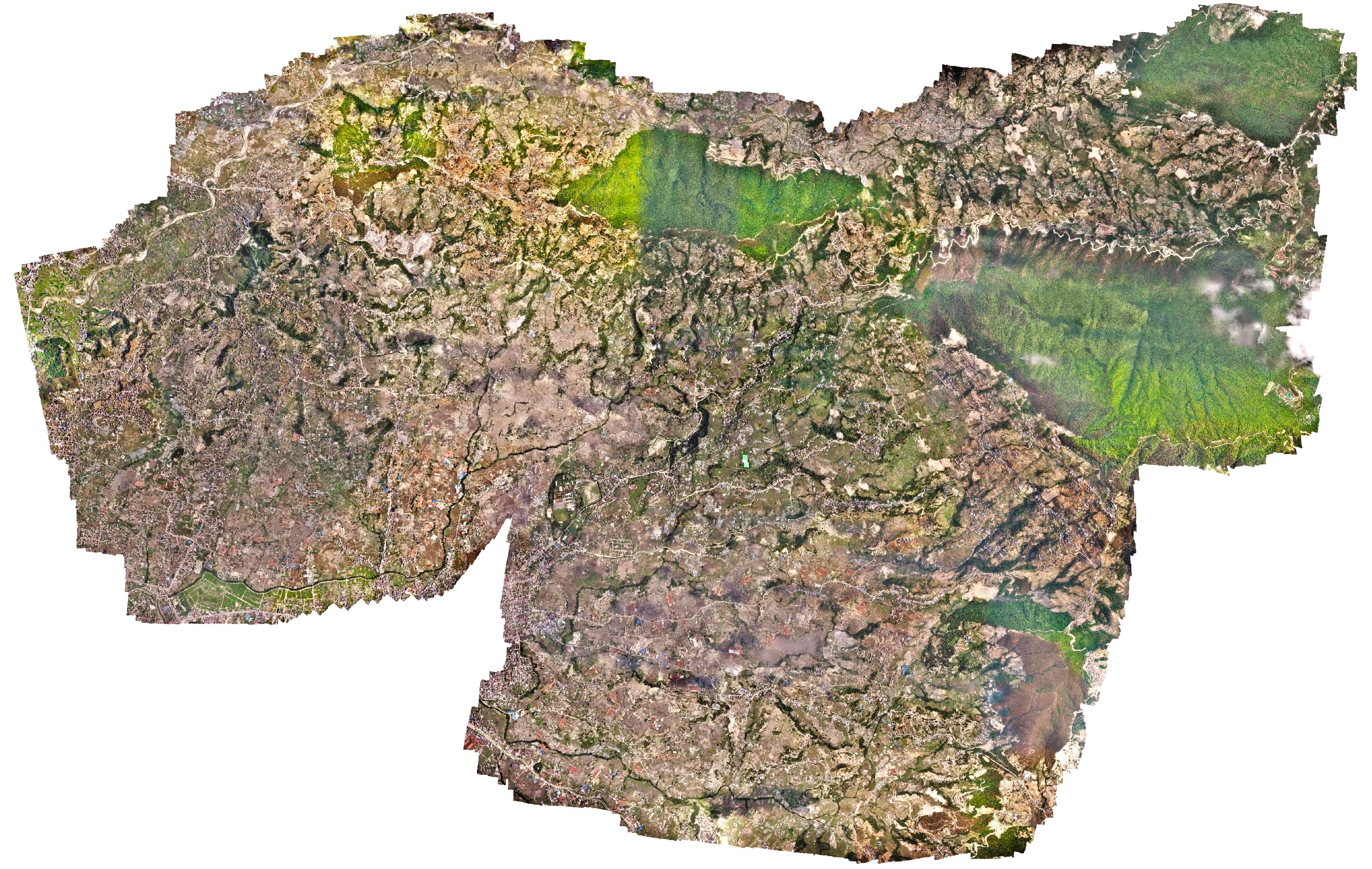
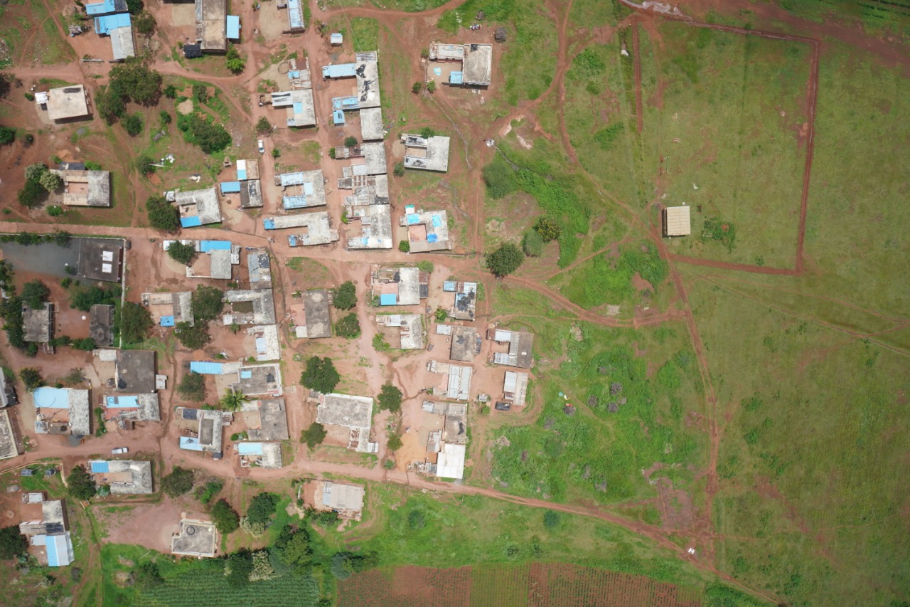
High resolution survey of an Urban municipality
Changu Narayan Municipality, an urban municipality in Kathmandu, approached Geovation to deploy our long-range drone to rapidly capture high-resolution drone images of the entire municipality. The work had to be carried out within nine days as the site was close to the airport. However, due to the ongoing COVID cases in the country, the imposed lockdown provided a limited traffic air space for easy deployment of the drones. Within 9 days, a 42-megapixel high-definition RGB sensor captured 11,000 images covering a total area of 64 square kilometers. The municipality later used those images with other tech consulting companies to generate street names and household numbers and also used them as baseline imagery in the open data portal.
Portfolio
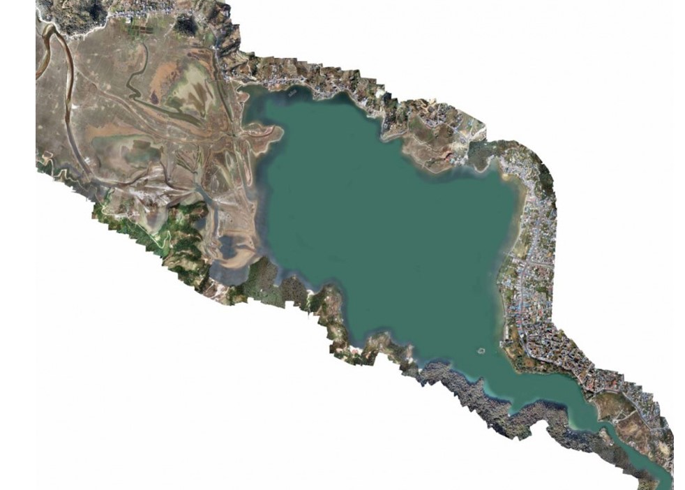
Drone based aerial survey of Phewa Lake
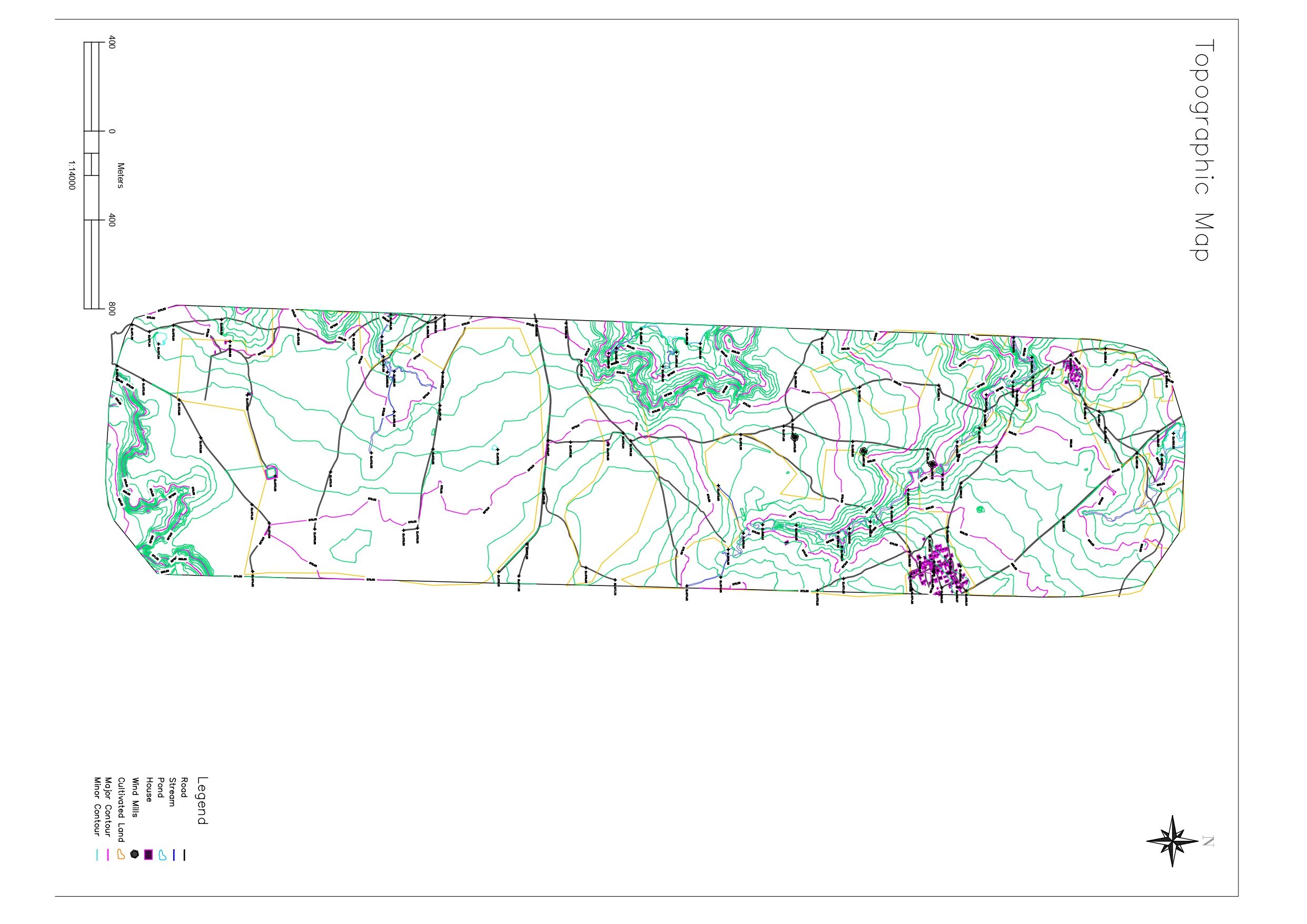
Geovation Nepal carried out an aerial survey using a drone to capture high-definition, geotagged images of Phewa Lake and its surroundings. Our team processed these images in image processing software to produce orthomosaics and elevations. Then, the obtained results were further analyzed and used to identify, demarcate, and map the Phewa Lake boundary in the MUTM (Modified-UTM) system.
Portfolio
High altitude Trail mapping and Surveys
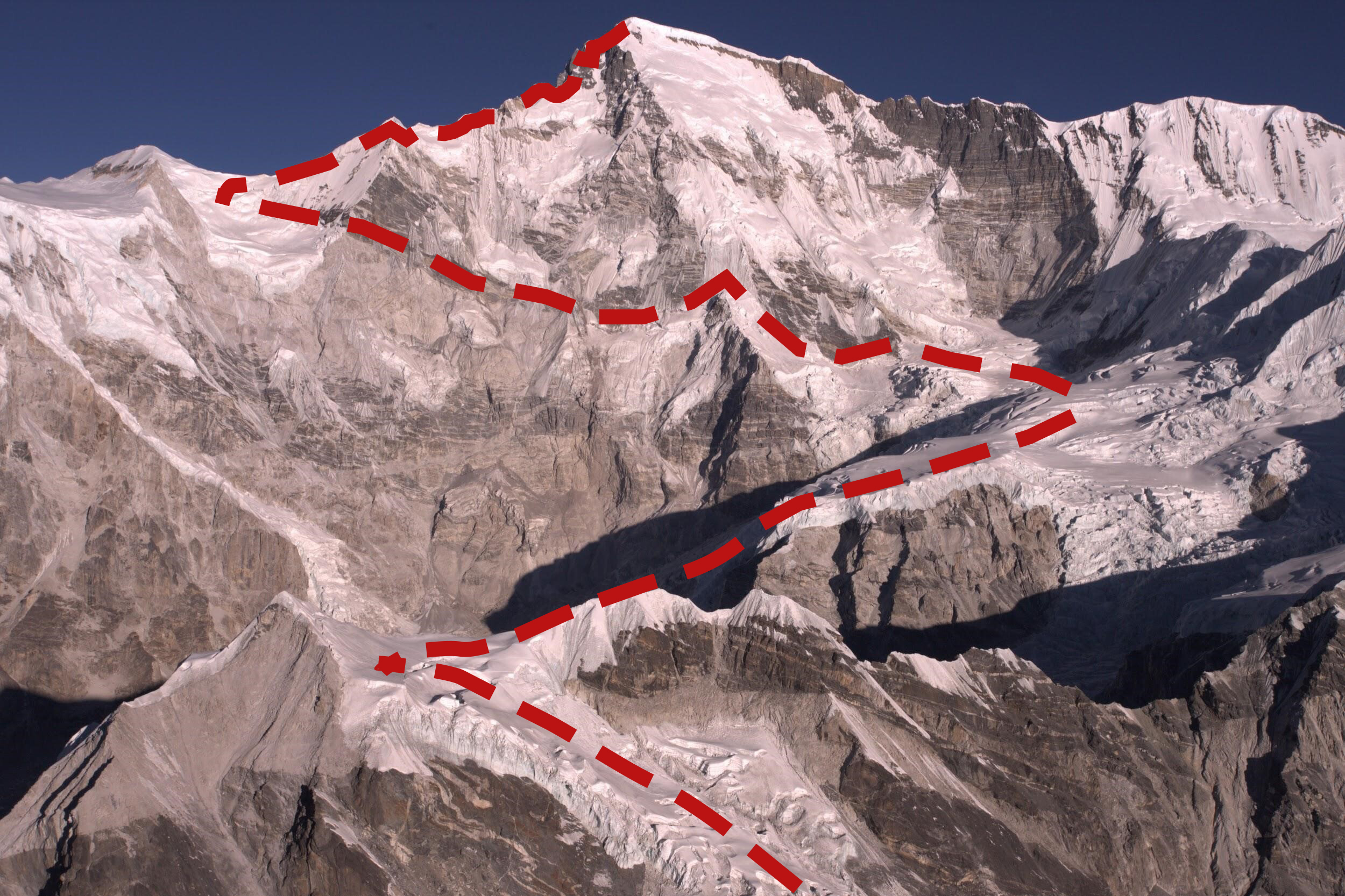
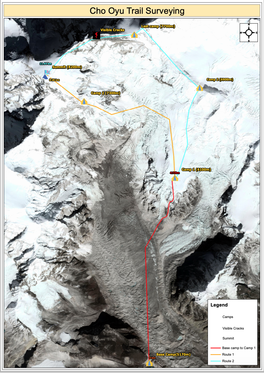
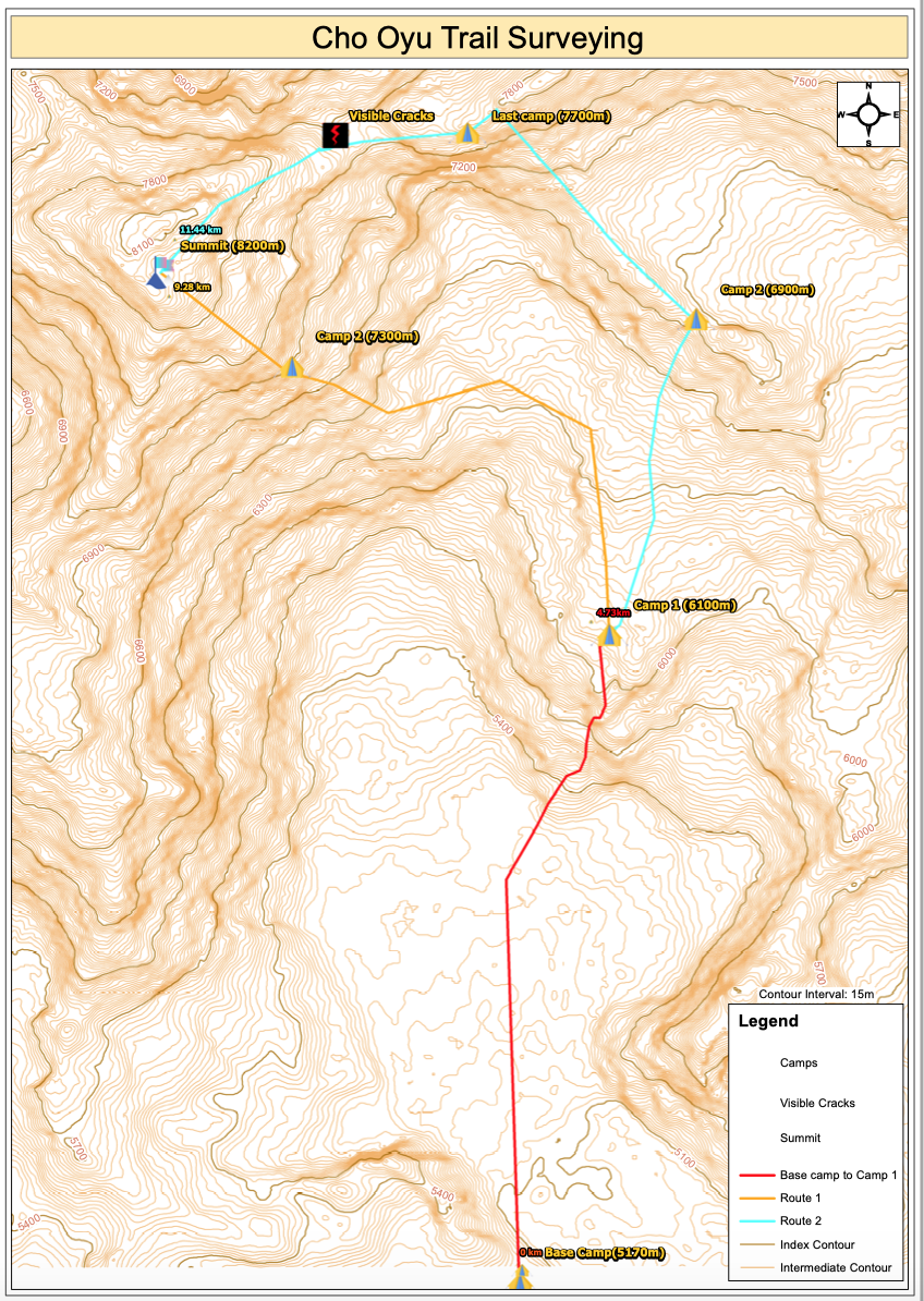
Mt. Cho- Oyu (8201m) in the Khumbu Himalayas under the Mahalangur Range is the fifth highest mountain in Nepal and the sixth highest in the world. Located in Nepal and the People’s Republic of China, this mountain is one of the most popular mountains for mountaineering tourists. Hundreds of climbers apply for the permit to climb this mountain every year, the technical aspects of this mountain are full of diversity, making it the choice of mountaineers. In this regard, a recce trip was made to explore the area prior to the technical team’s task. A team led by the representatives of the Ministry of Culture, Tourism, and Civil Aviation, the Department of Tourism, the Nepal Tourism Board, and the Nepal mountaineering Association headed to the region for the aerial study. A drone pilot and a photographer accompanied the team for visual documentation.
The aerial recce trip was conducted to understand the terrain of the mountains in order to identify the safe mountaineering route for commercial mountain climbing. The route which mountaineers follow from the Nepal side has very little ascent, is technically difficult and has had cases of accidents with casualties. The team also projected an orthophoto map that identified big cracks and possible risks in the route.
Portfolio
Rapid damage assessment of Melamchi Flood
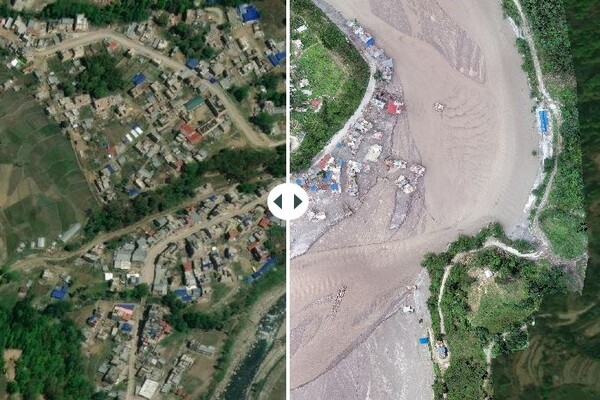
The occurrences of natural hazards are inevitable in the Nepal Himalaya due to active tectonics and strong monsoon. These hazards are turned into disasters claiming lives and destroying properties. The Melamchi Flood is one the recent extreme disasters that occurred in the late night of June 15. The debris flow hit the Melamchi Bazaar and destroyed a number of houses, infrastructure along the road corridor. This debris flood partly destroyed the Headworks of the Melamchi Water supply project.
Immediately after the Melamchi Flood, Sinchupalchowk, our team of drone pilots and Disaster Risk Reduction and Management (DRRM) experts were deployed to the flooding area to obtain first-hand situational ground information for rapid visual damage assessment. On the following day, our team moved to conduct an aerial inspection particularly in the headworks area. Complying with the Standard Operation Procedures (SOPs), National Drone Operational Guidelines and the Humanitarian Unmanned Aerial Vehicle (UAV) Code of Conduct, flight missions were planned as the team prepared for the field. The team took off from Amathang, a nearby settlement 2 km from the headworks area, capturing high resolution images of the catastrophe. Further, deskwork was carried out to generate the required for the project. Click here to view our story map
Portfolio
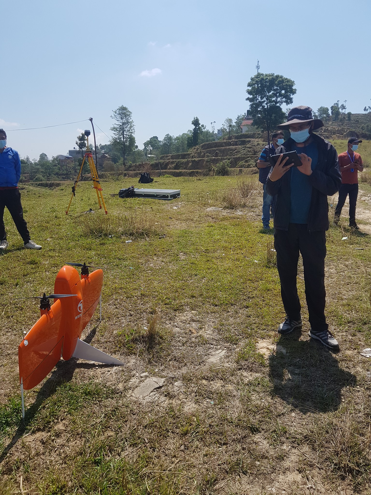
Drone pilot training for Nepal Police and WRRDC
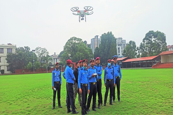
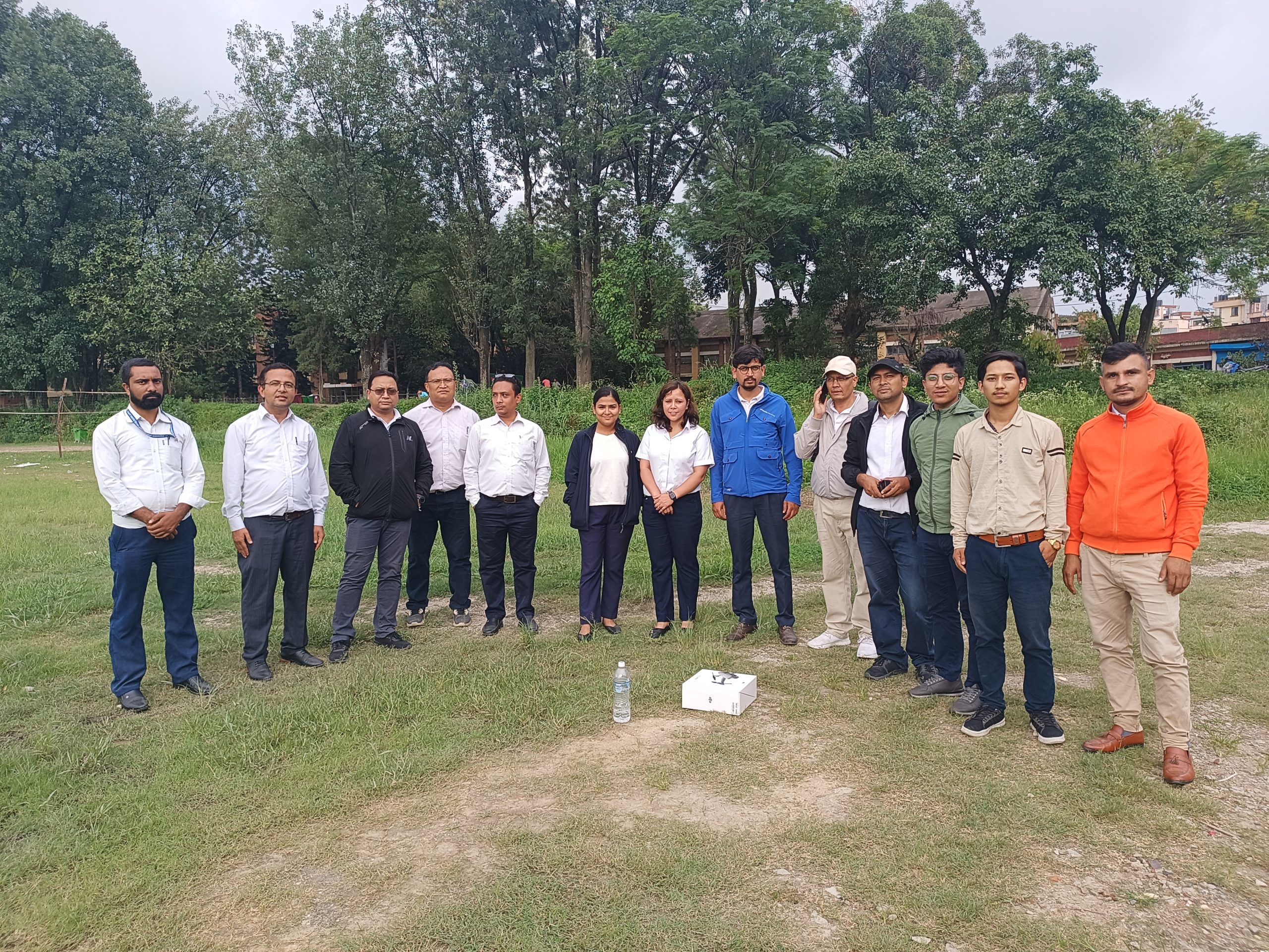
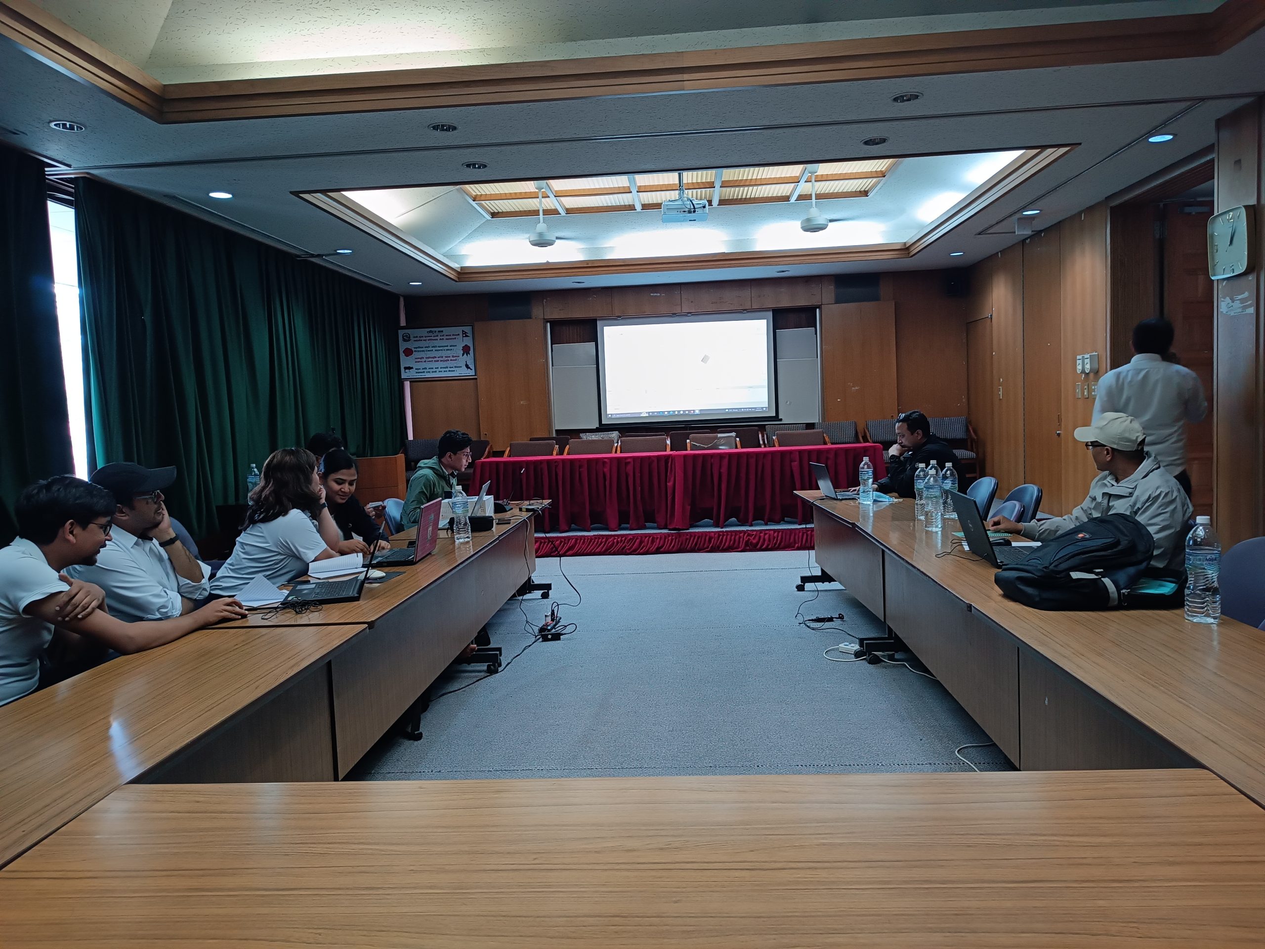
At Geovation, we also provide drone-based data collection and analysis training to interested people from different agencies. Under these projects, the technical team conducted two days of training for the Nepal police on drone data acquisition and post-processing for disaster assessment and management.
Likewise, we also provided a two-day training for the WRRDC organization to assist them in using drones for water resource research and management.
Portfolio
Hyderabad, India – Drone Based Aerial Survey
The firm had successfully completed its first international project for Hyundai Motor Company in India. The project objectives were to conduct drone based aerial surveys for capturing high resolution imageries for a construction site. Furthermore, to use the collected images to generate 2d models i.e Orthomosaic, DSM and DTM as well as 3d point cloud and 3d model, finally converting the processed data to CAD compatible format for designing and construction of the new manufacturing plant.