Portfolio Type: Urban Planning
Portfolio
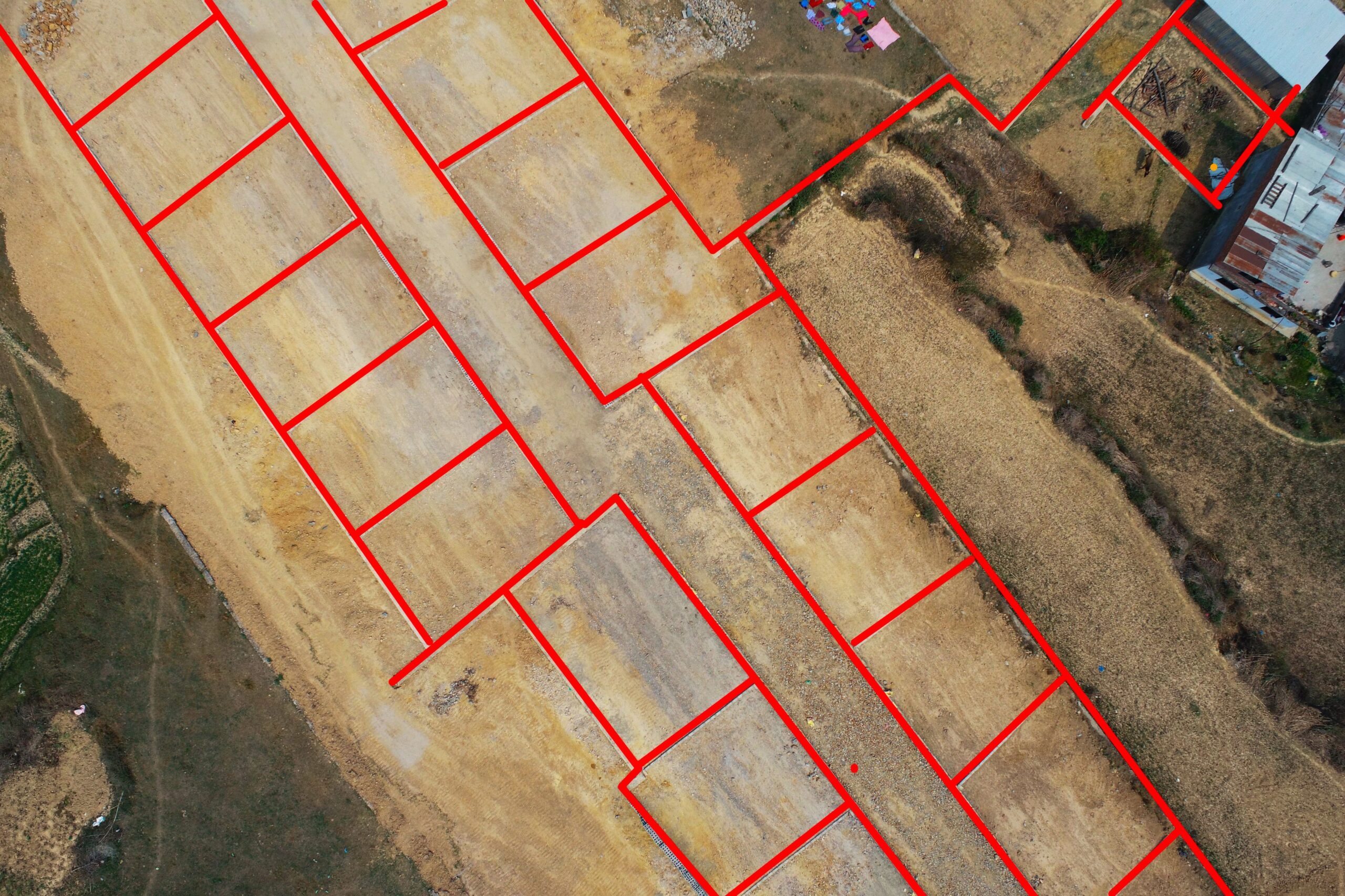
Land Planning, Lalitpur – Drone Based Survey
Lalitpur District has seen many planned infrastructure developments, for instance planned housing colonies in the last two decades due to increase in land pooling projects. People are more inclined towards well organized and planned infrastructure development. The Land pooling project was carried out in Lalitpur district. Drone based aerial survey was conducted for the site to obtain high resolution aerial imageries. These imageries were further used to generate orthomosaic, 3D Model and elevation models. These results were used for topographic feature extraction , terrain visualization and cadastral analysis.
Portfolio
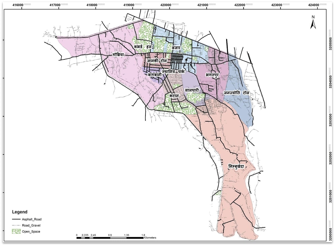
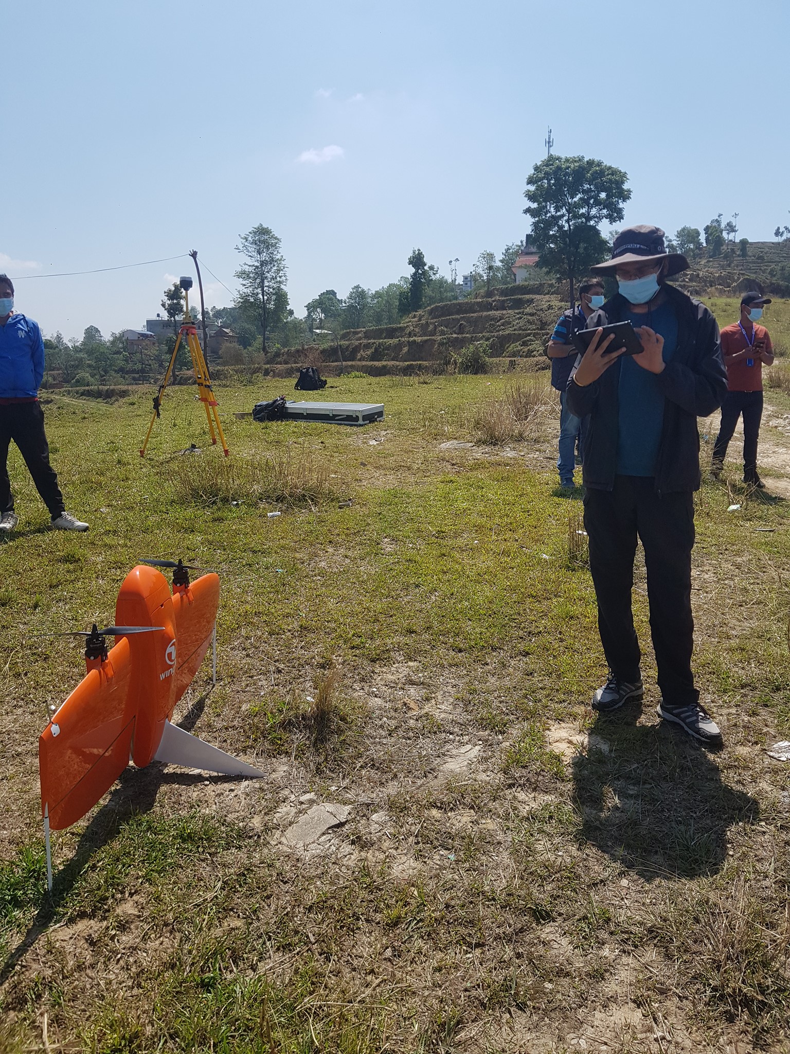
Harion municipality drone survey and mapping
The newly formed Harion municipality required spatial data to carry out overall development of infrastructures in a speedy manner. Municipality is in need of knowledge on landuse and land cover, knowing land structures, hazard risk analysis, hydrological modeling and topography and so on. Spatial data can provide a baseline data for construction works as well as emergency response analysis.
UAV based aerial survey was carried out to prepare orthomosaic and elevation models. The obtained data were georeferenced using Post Processing Kinematics (PPK) technology. These generated results will be further used for preparing geodatabase, and different thematic maps will be prepared. FInally, orthomosaic will be used as a baseline reference for further analysis and modeling.
Portfolio
Drone Based Aerial Survey for Land Pooling
Mahalxami municipality, a municipality in Lalitpur district, is rapidly transforming into an urban area. Mahalaxmi Land pooling project was carried out for developing a residential colony. Our team acquired drone based aerial images. Further, desk work was carried out to generate 3D model, orthomosaic and Digital Elevation Models for feature extraction and visualization. The extracted features were converted into cad compatible format for further analysis.
Portfolio
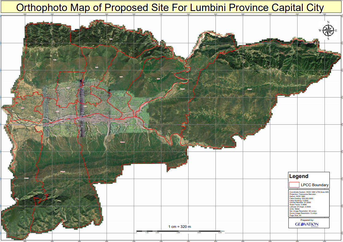
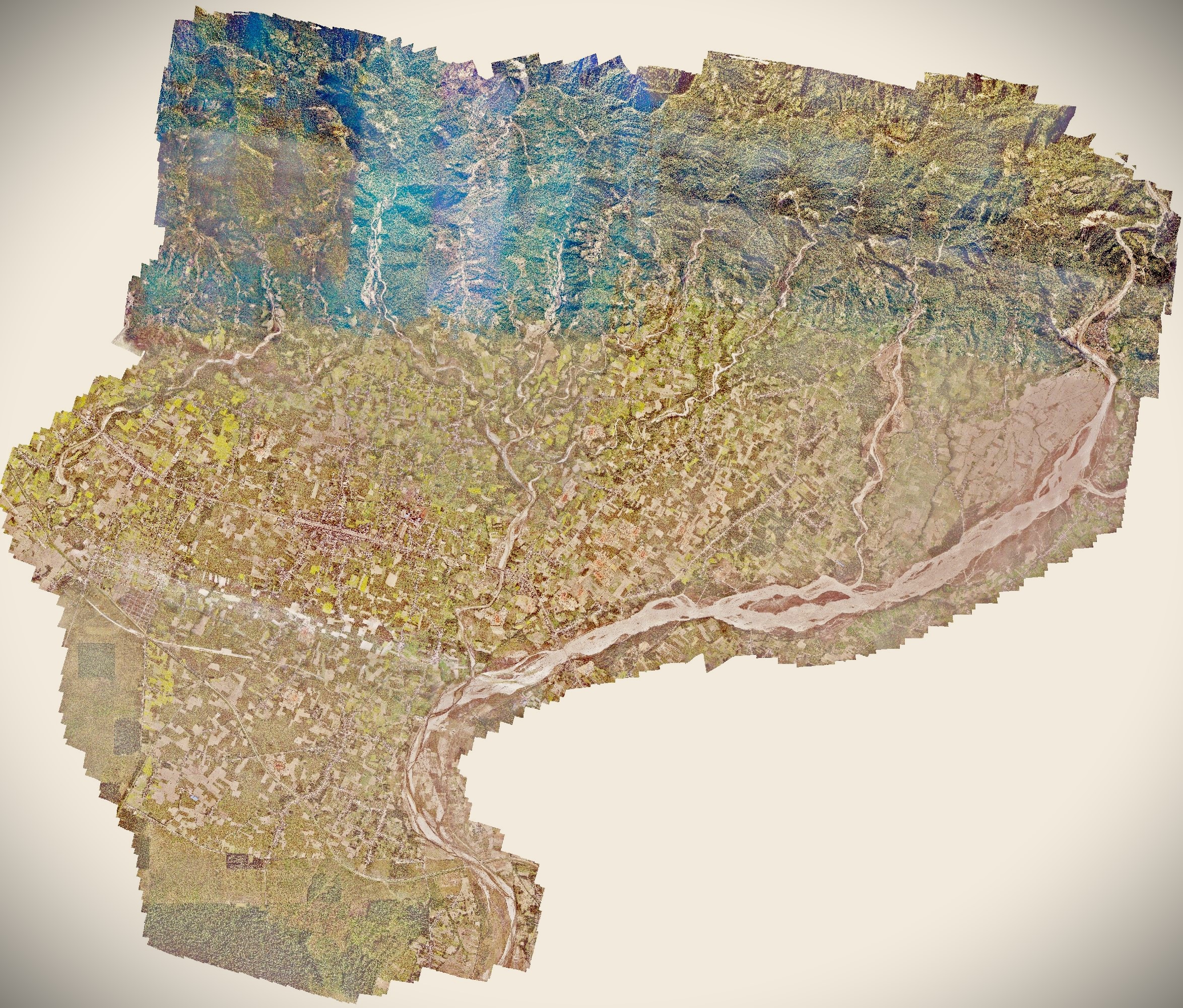
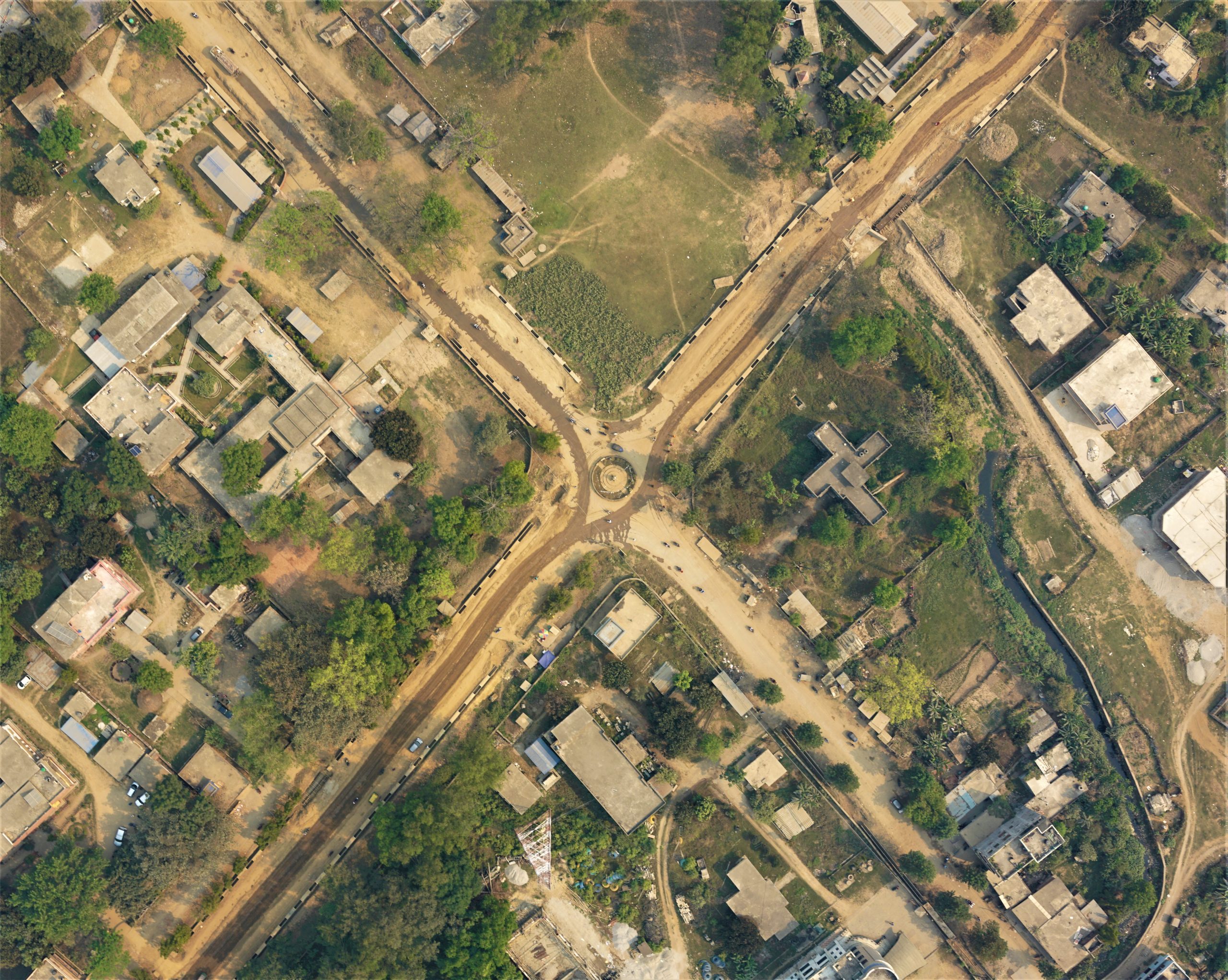
Drone based aerial survey of Lumbini Province Capi
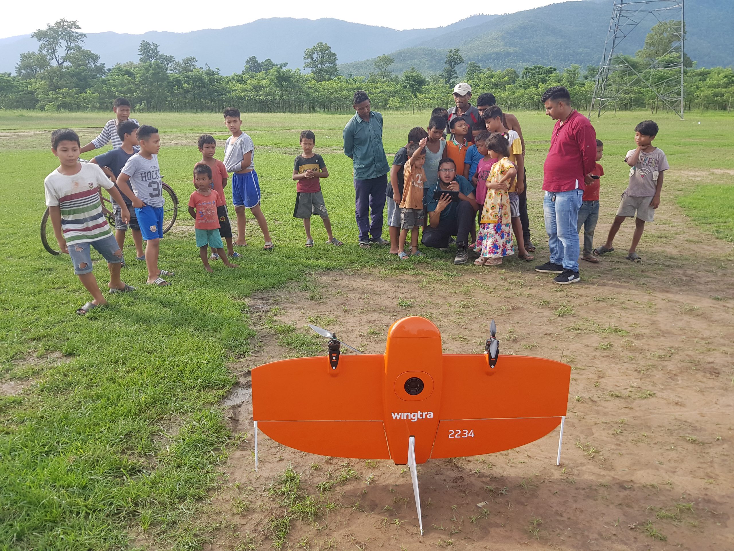
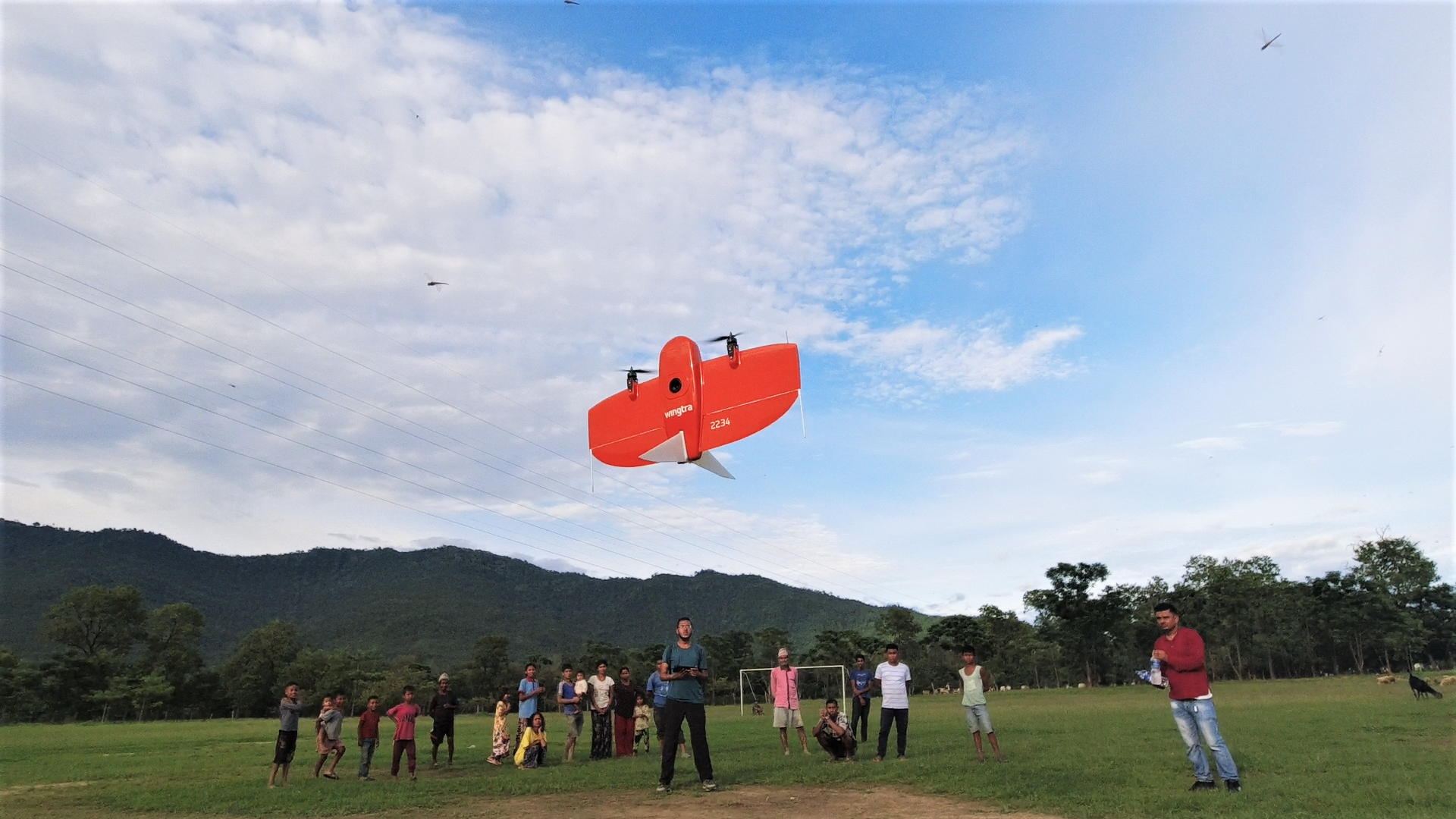
On October 06, 2020 Chief minister of Lumbini province declared Bhaluwang and its nearby area as its capital city. But it needs to be built from scratch as it has minimum infrastructure. For proper development of a new city in a sustainable way, it requires precise spatial datasets. The geovation nepal took this challenging project, and used its best in class equipments Wingtra one gen II drone (A survey grade drone), enabled with PPK (Post Processing Kinematics) technology to generate high resolution orthmosaic map of the site maintaining the GSD of 5.05 cm/pix.
Portfolio
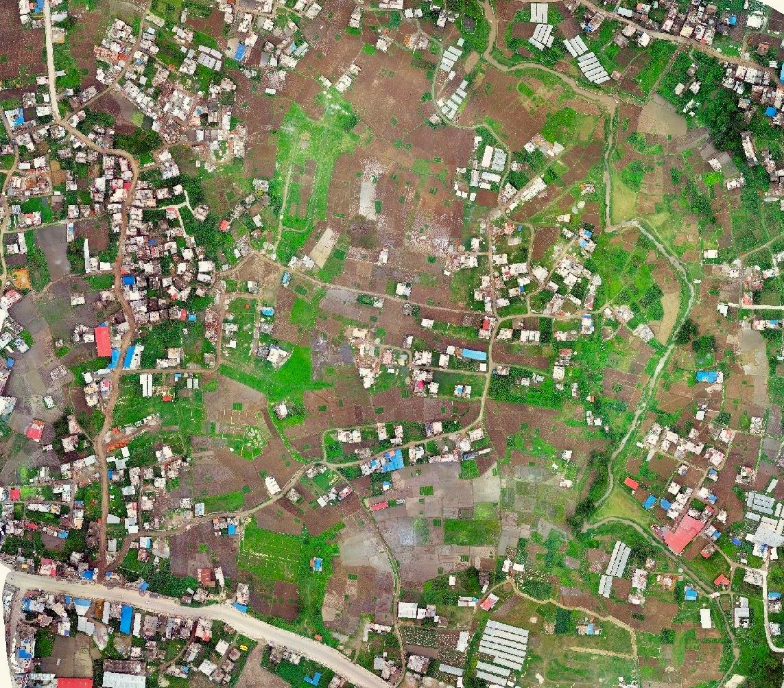
Bheemdutta drone survey and mapping
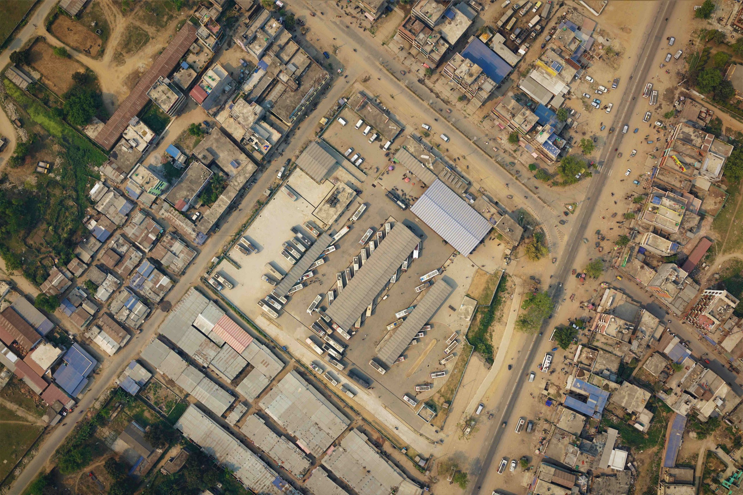
The technical team from Geovation Nepal carried out an airborne survey in two wards (Ward 04 and Ward 18) of Bhimdutta Municipality. The obtained high resolution images were used to generate a high resolution orthomosaic, Digital Elevation Models. A geodatabase that includes natural and manmade features such as building footprints, road lines, openspaces was prepared through these outputs to prepare topographic maps, Landuse maps. These results were used for house survey, humanitarian open space mapping and to identify present condition of roads within two wards.
Portfolio
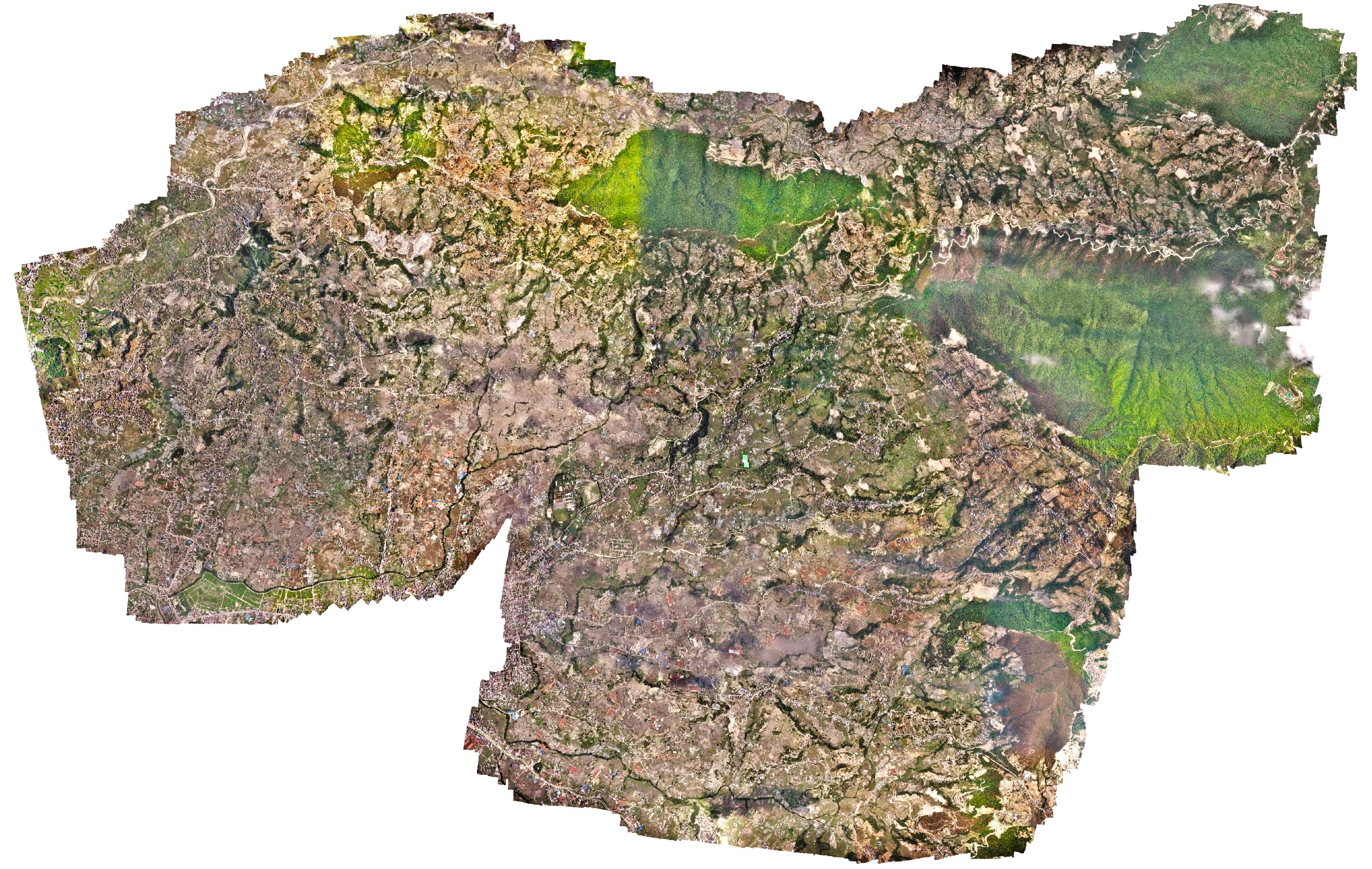
High resolution survey of an Urban municipality
Changu Narayan Municipality, an urban municipality in Kathmandu, approached Geovation to deploy our long-range drone to rapidly capture high-resolution drone images of the entire municipality. The work had to be carried out within nine days as the site was close to the airport. However, due to the ongoing COVID cases in the country, the imposed lockdown provided a limited traffic air space for easy deployment of the drones. Within 9 days, a 42-megapixel high-definition RGB sensor captured 11,000 images covering a total area of 64 square kilometers. The municipality later used those images with other tech consulting companies to generate street names and household numbers and also used them as baseline imagery in the open data portal.