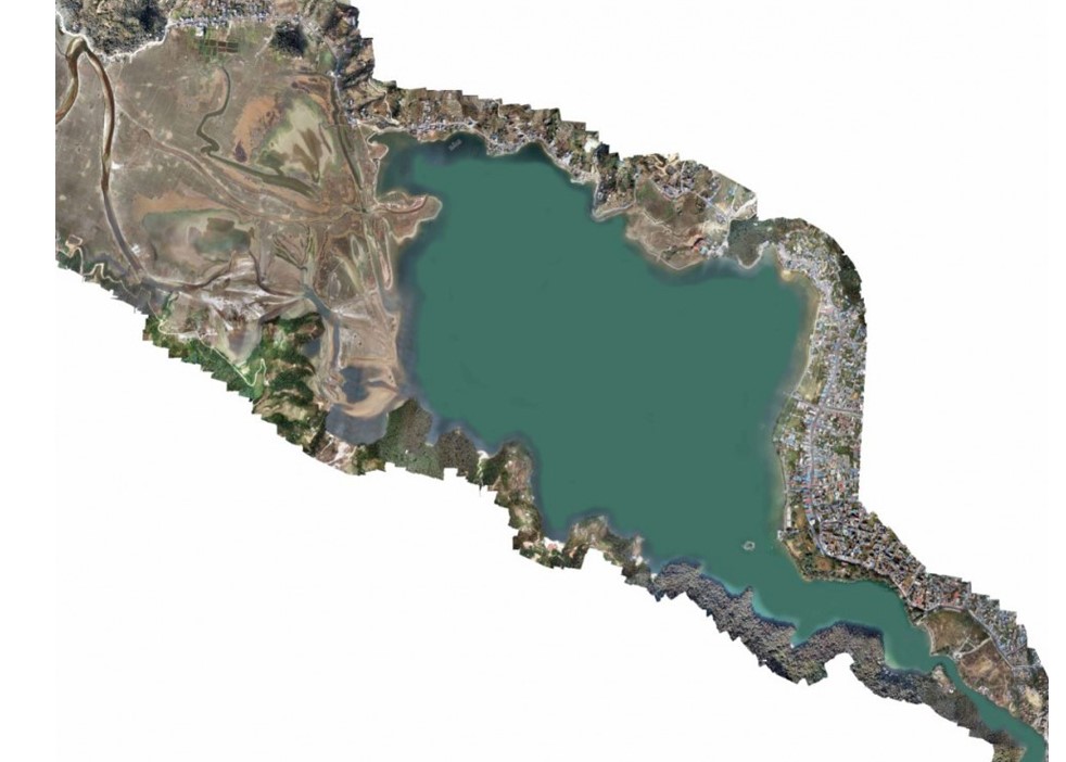
Drone based aerial survey of Phewa Lake
Geovation Nepal carried out an aerial survey using a drone to capture high-definition, geotagged images of Phewa Lake and its surroundings. Our team processed these images in image processing software to produce orthomosaics and elevations. Then, the obtained results were further analyzed and used to identify, demarcate, and map the Phewa Lake boundary in the MUTM (Modified-UTM) system.