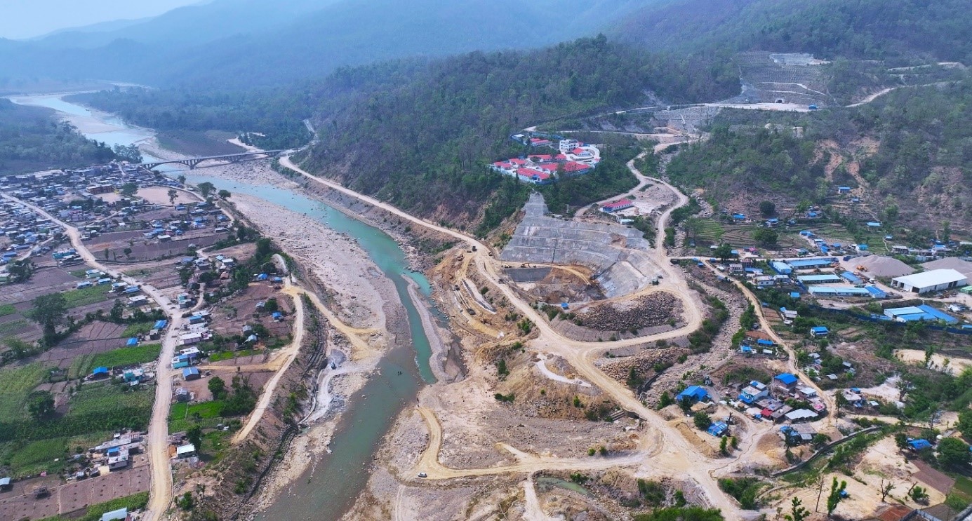
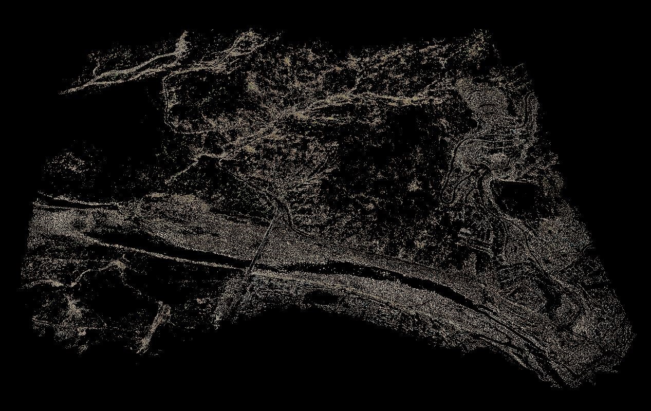
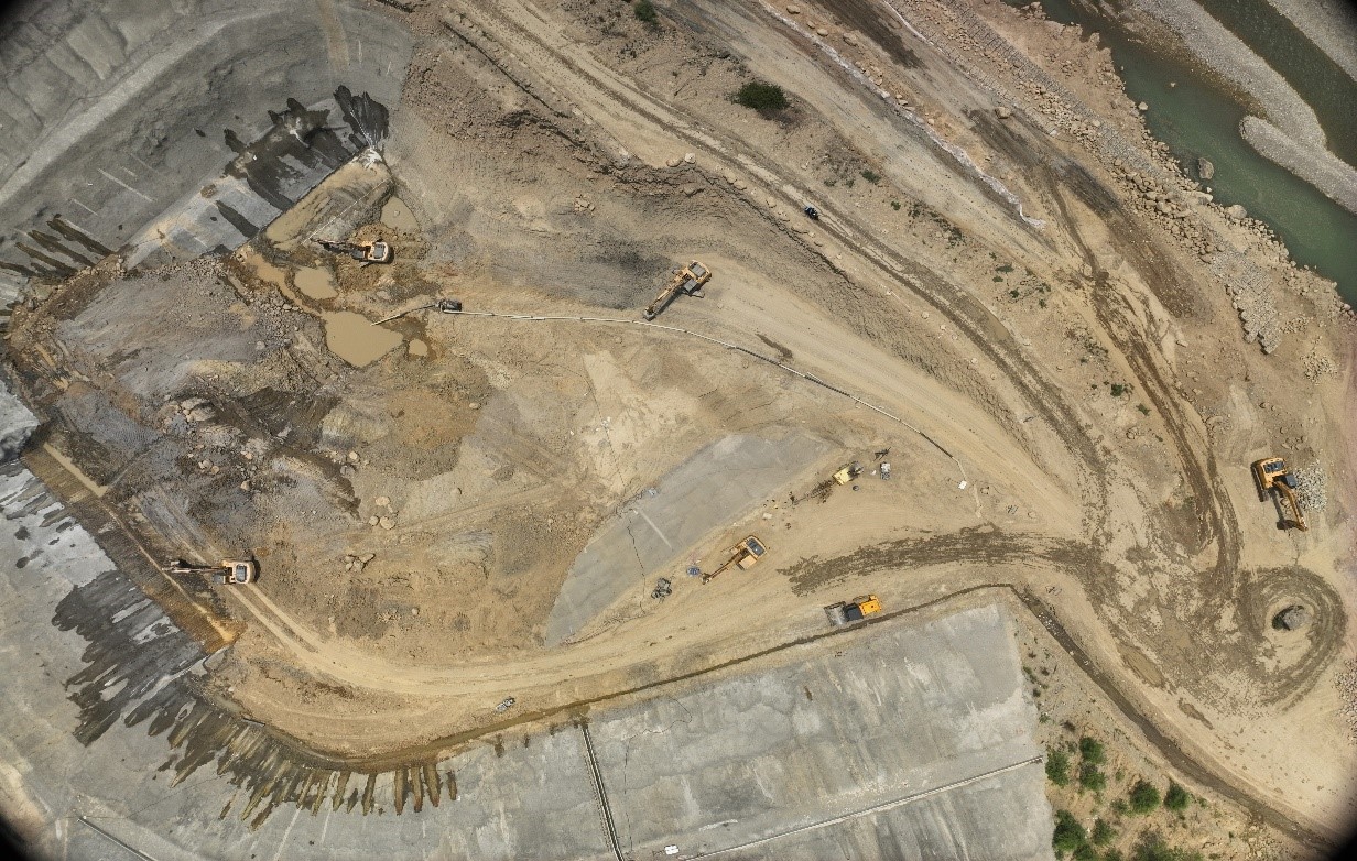
Precision Mapping: UAV-LiDAR Survey for Bheri Baba
The UAV-LiDAR survey, conducted by our team at Geovation for NEA, was vital for the Bheri Babai Diversion Multipurpose Project, addressing irrigation and hydroelectric needs in Karnali province. This project relied on topographical mapping to navigate the diverse landscapes of the Bheri and Babai rivers. The data enabled informed decision-making and accurate infrastructure development, reducing environmental impacts and increasing project reliability.
Our advanced mapping technology ensured that all critical features were accurately documented, aiding in the efficient and sustainable execution of the project’s objectives.
This drone-based survey and aerial mapping in Nepal shows the dedication to using the latest technology for precise and reliable results.