Portfolio Type: Survey & Mapping
Portfolio
Tanahu Hydro Power
At present, we as the leading UAV service provider company are trying to facilitate UAVs in multiple domains possible. In this pursuit, we conducted the project to acquire high resolution drone based imageries to acquire data for pre feasibility study of a hydropower. High resolution orthophoto was the major output of this project. The generated outputs were used to estimate and evaluate the potential area that would be submerged due to the construction of the dam and identify the possible areas to relocate affected people to new places.
Portfolio
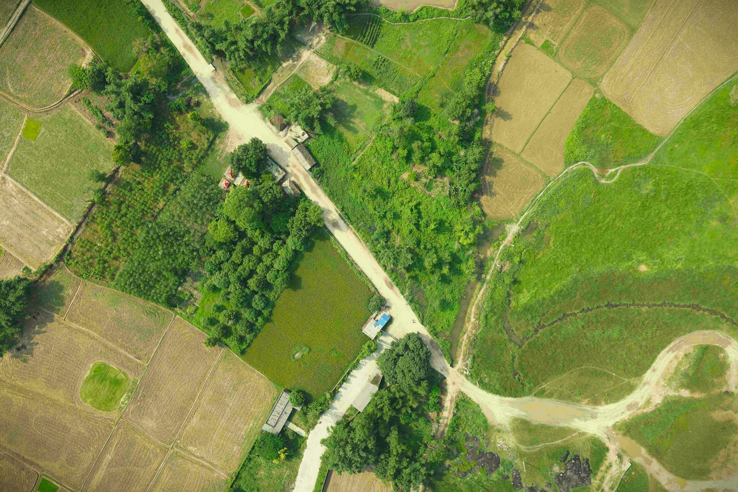
Drone based irrigation survey in Simara
The drone based aerial survey was carried out to analyze the present condition of the irrigation network and further expand the irrigation network based on the generated orthomosaic and elevation models, to make water available for all agricultural lands within the project area.
Portfolio
Land Planning, Lalitpur – Drone Based Survey
Lalitpur District has seen many planned infrastructure developments, for instance planned housing colonies in the last two decades due to increase in land pooling projects. People are more inclined towards well organized and planned infrastructure development. The Land pooling project was carried out in Lalitpur district. Drone based aerial survey was conducted for the site to obtain high resolution aerial imageries. These imageries were further used to generate orthomosaic, 3D Model and elevation models. These results were used for topographic feature extraction , terrain visualization and cadastral analysis.
Portfolio
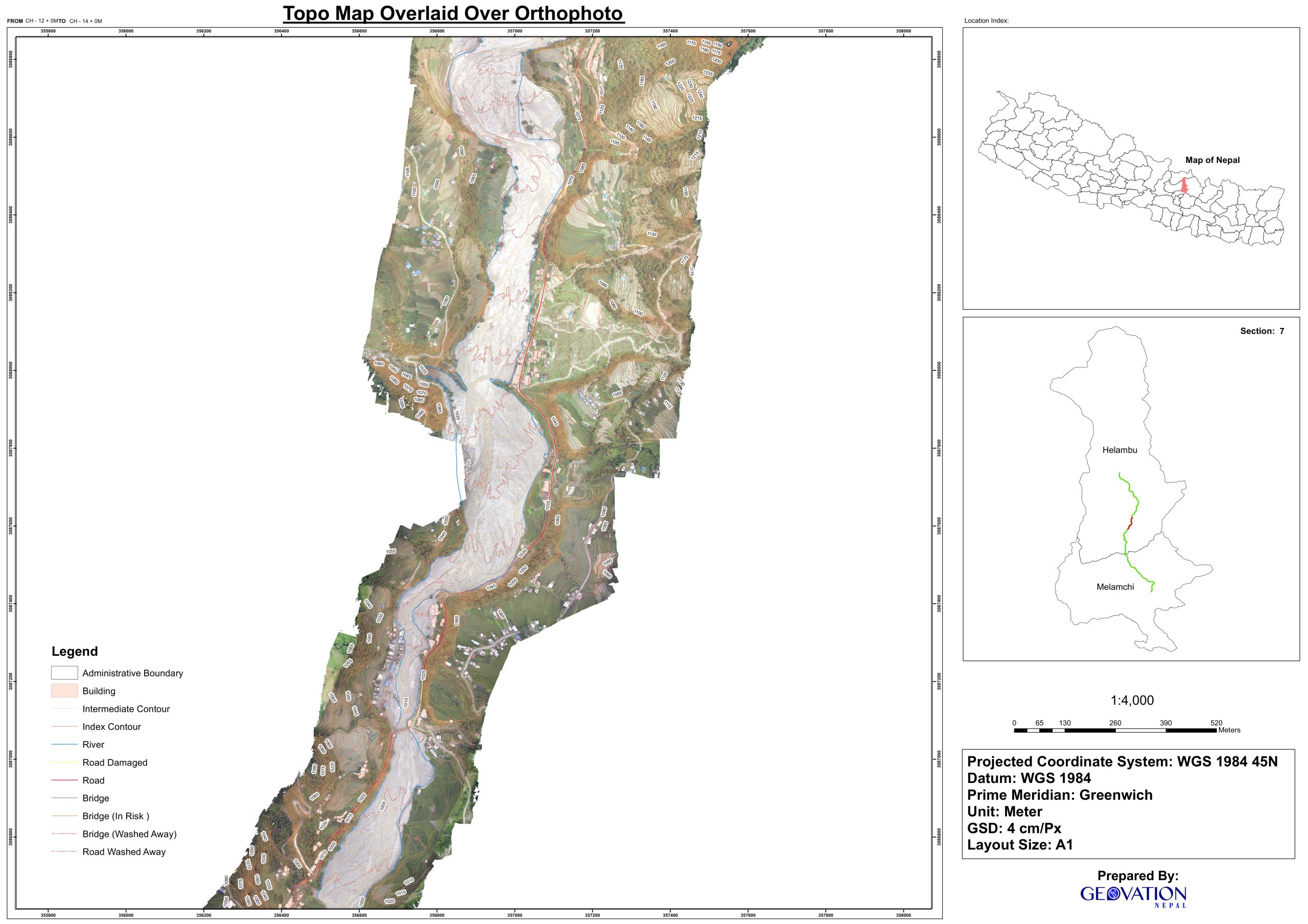
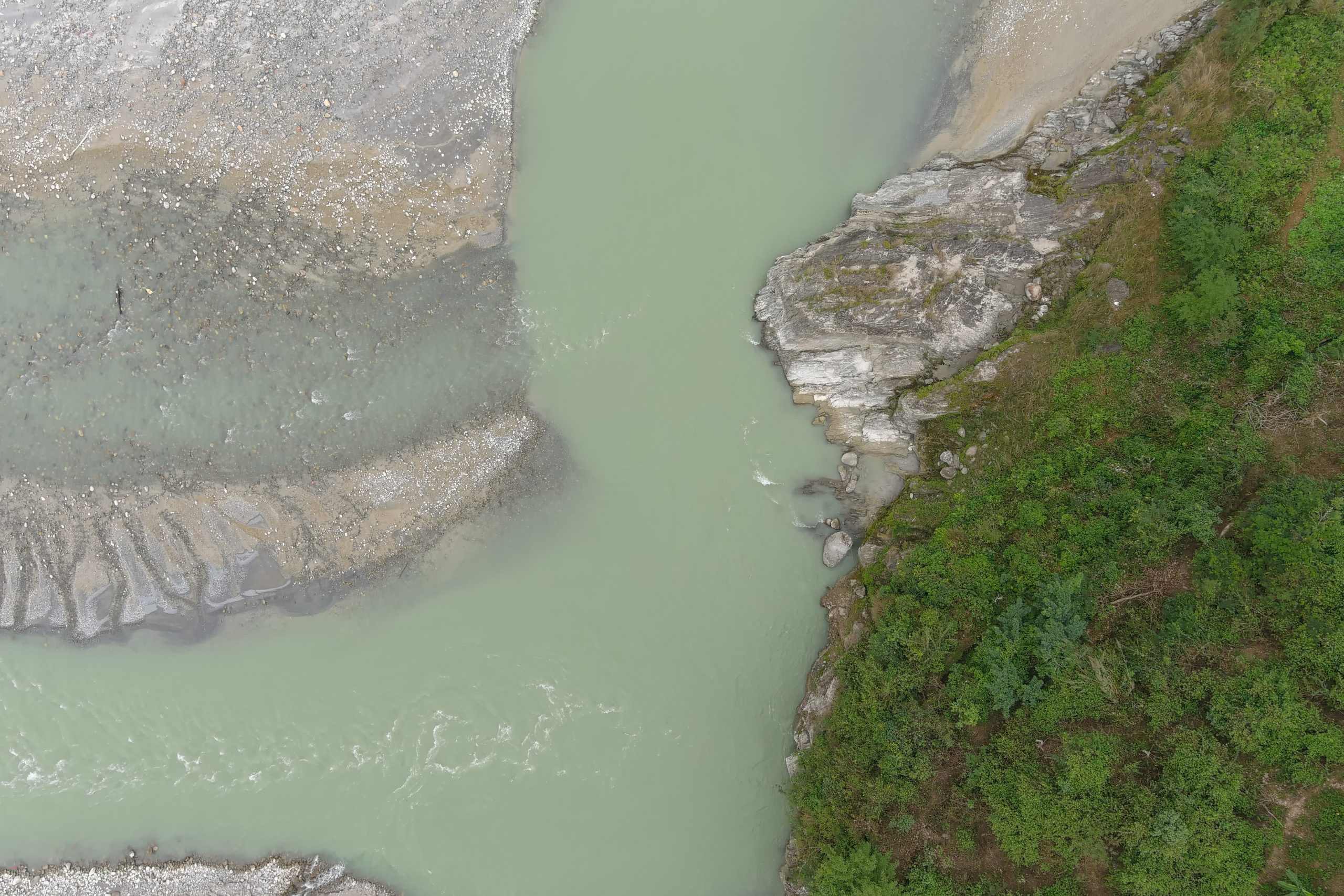
Melamchi Road Segment: UAV Based Aerial Photogramm
The disastrous flood of melamchi in the monsoon season of 2021 claimed hundreds of human lifes and thousands of people became homeless. The natural disaster not only affected many infrastructure but completely wiped them away. Concrete buildings, multiple bridges, drinking water supply network as well as electricity were affected as a whole. Mainly the road section joining melamchi pul bazar and melamchi drinking water project headworks was completely washed out. A drone based aerial survey was carried to obtain high resolution images to obtain detailed orthomosaic, precise digital elevation models and 3d models. Further these results were used to prepare topographic maps, profile and cross sections were also generated. These outputs were further converted to CAD format for creating designs for new roads.
Portfolio
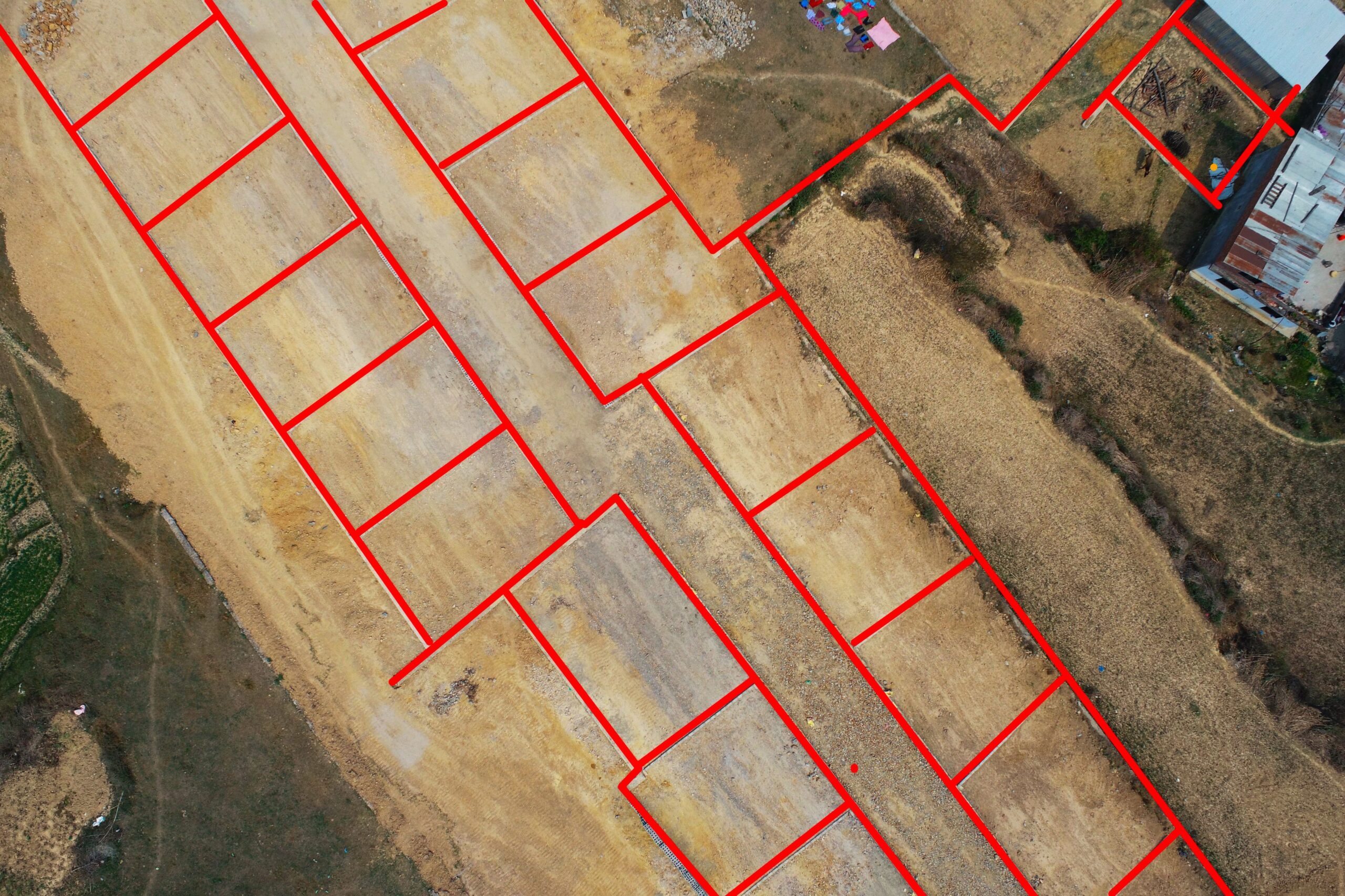
Drone Based Aerial Survey for Land Pooling
Mahalxami municipality, a municipality in Lalitpur district, is rapidly transforming into an urban area. Mahalaxmi Land pooling project was carried out for developing a residential colony. Our team acquired drone based aerial images. Further, desk work was carried out to generate 3D model, orthomosaic and Digital Elevation Models for feature extraction and visualization. The extracted features were converted into cad compatible format for further analysis.
Portfolio
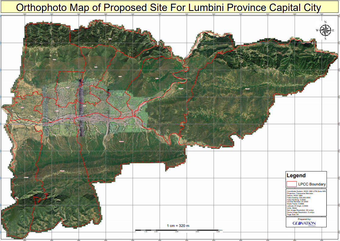
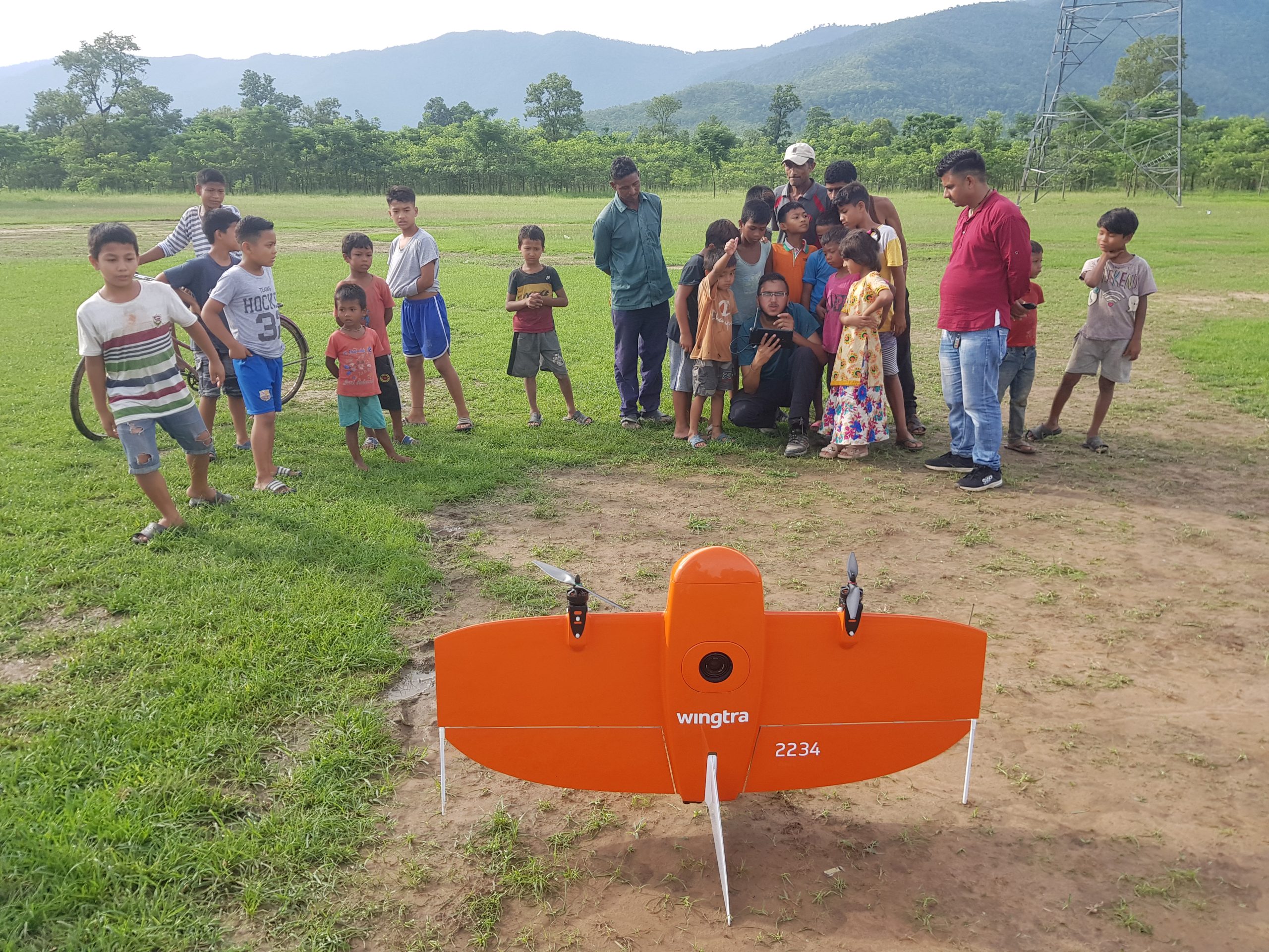
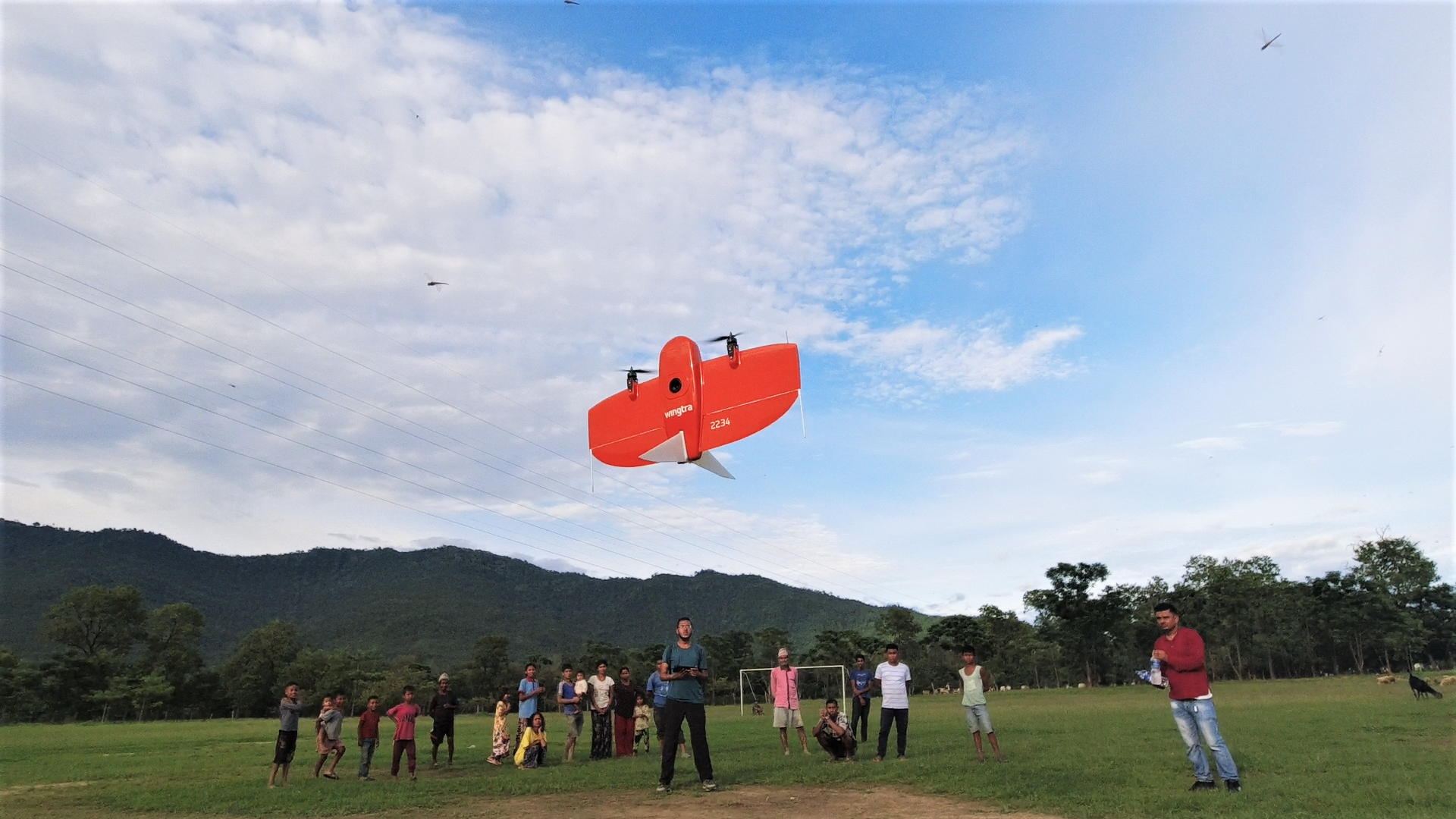
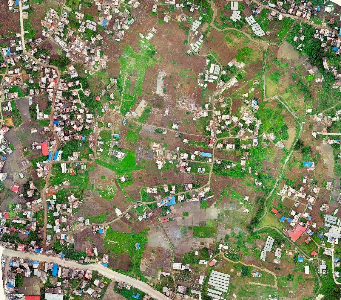
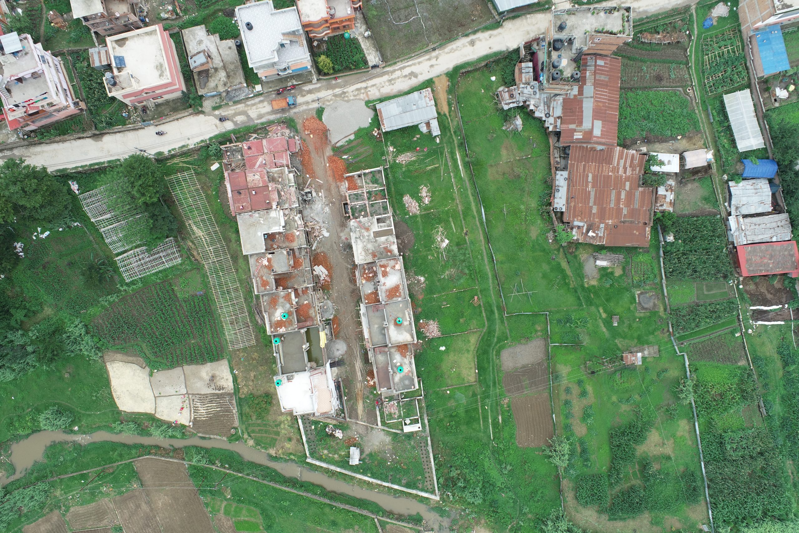
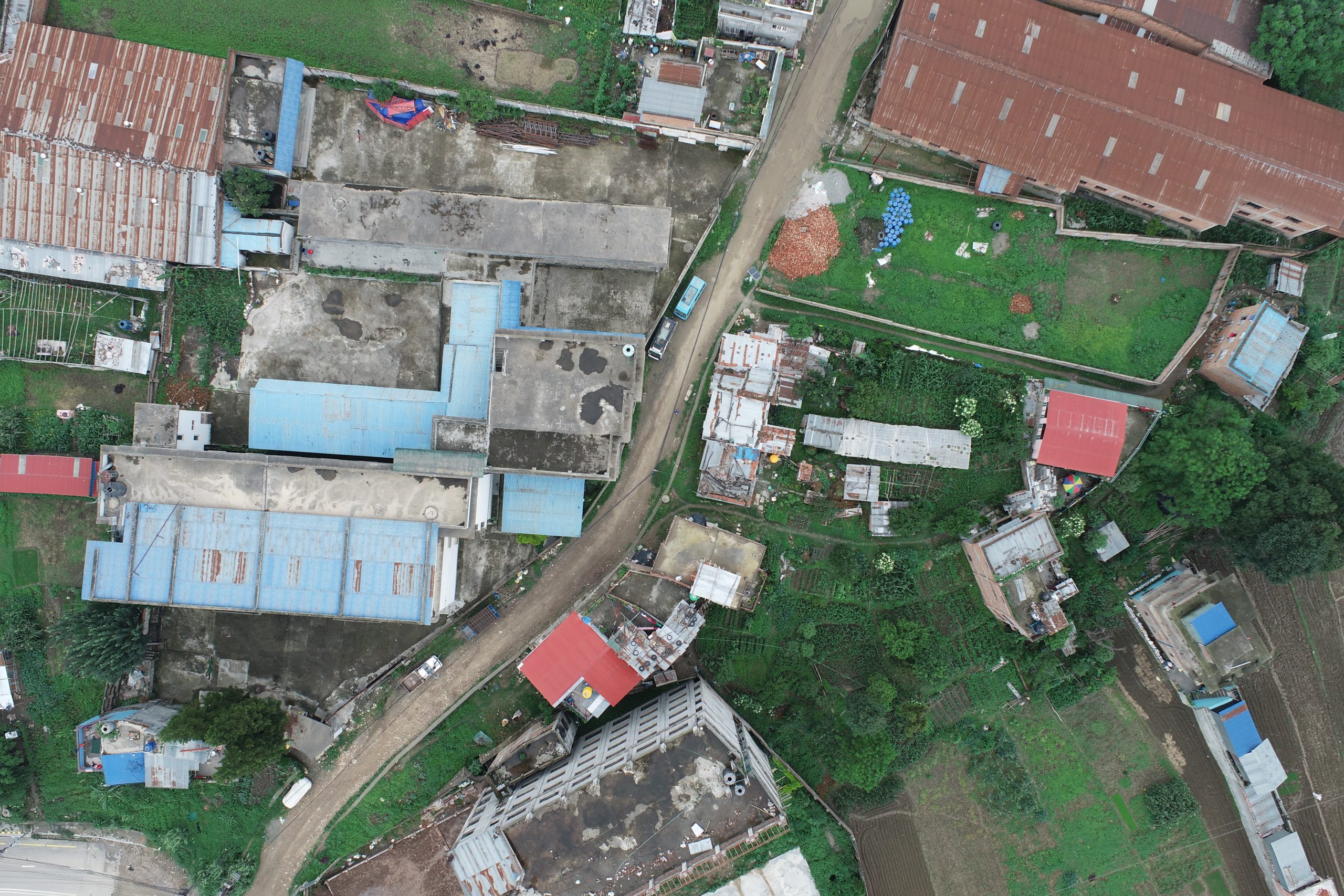
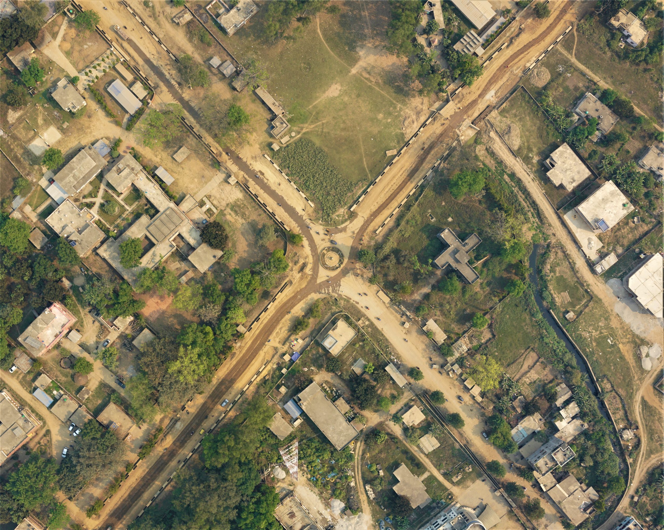
Drone based aerial survey of Lumbini Province Capi
On October 06, 2020 Chief minister of Lumbini province declared Bhaluwang and its nearby area as its capital city. But it needs to be built from scratch as it has minimum infrastructure. For proper development of a new city in a sustainable way, it requires precise spatial datasets. The geovation nepal took this challenging project, and used its best in class equipments Wingtra one gen II drone (A survey grade drone), enabled with PPK (Post Processing Kinematics) technology to generate high resolution orthmosaic map of the site maintaining the GSD of 5.05 cm/pix.
Portfolio

Aerial photogrammetry services Ortho-Photographs a
Aerial Photogrammetry for Ortho-Photographs and Topographic Maps
This project was carried out for the topographical map of three proposed Hospital Sites inside Kathmandu valley. It was supported by the Ministry of Health and Population. High resolution orthophoto and high accurate topographical map was the major output of this project.
Portfolio
Pokhara: Drone-Based Aerial Survey for Flood Manag
Flooding has been a problem for residents near Kamalpokhari located in Ward no 13 of Pokhara for several years. The concerned authorities needed geospatial data to investigate the causes of flooding and to develop prevention strategies. The team from Geovation Nepal conducted drone based aerial surveys to collect high resolution images. The captured high resolution images were used to generate an orthomosaic and Digital Elevation Model. These generated outputs will be used to create new plans to prevent the flood that occurs during monsoon season near Kamalpokhari lake in Pokhara metropolitan city.
Portfolio
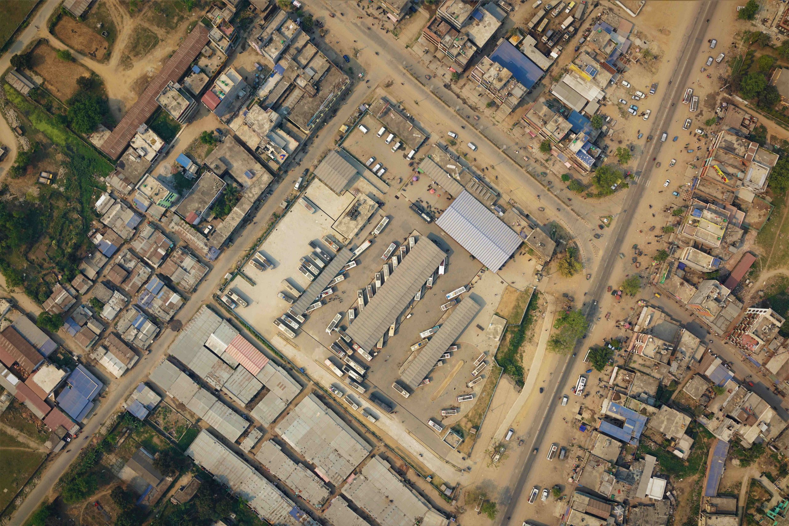
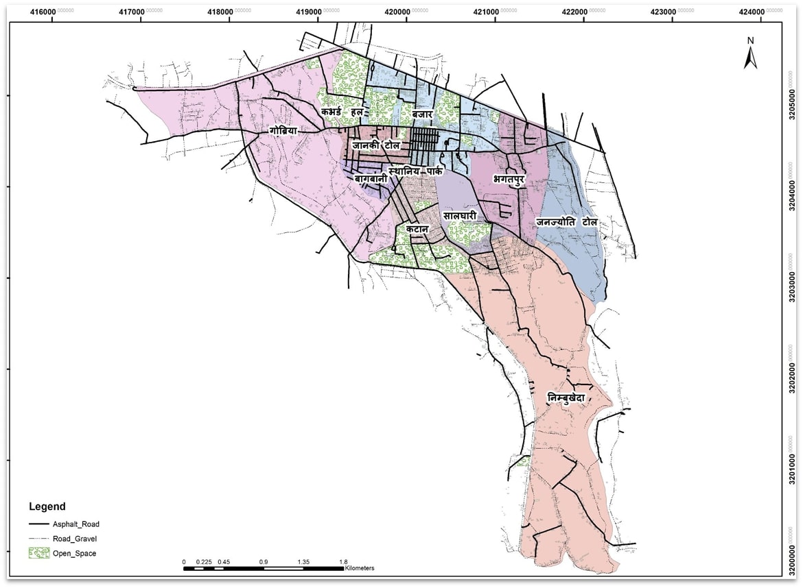
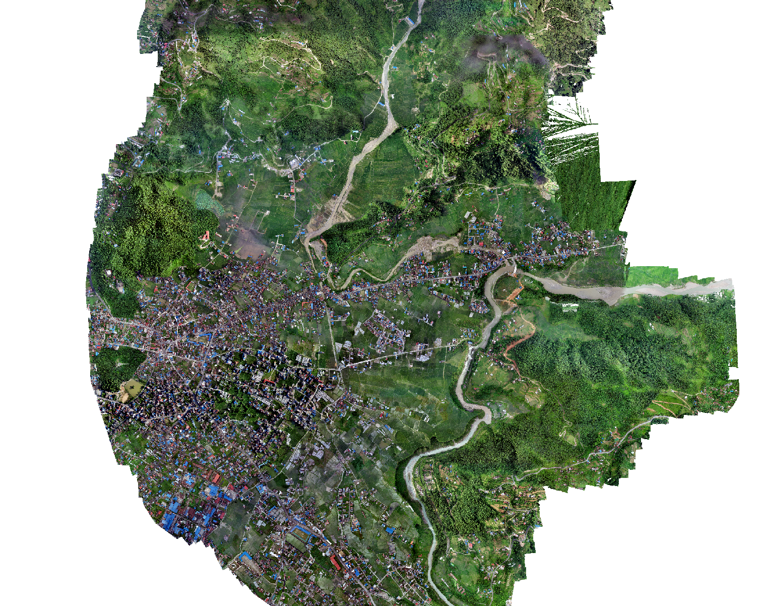
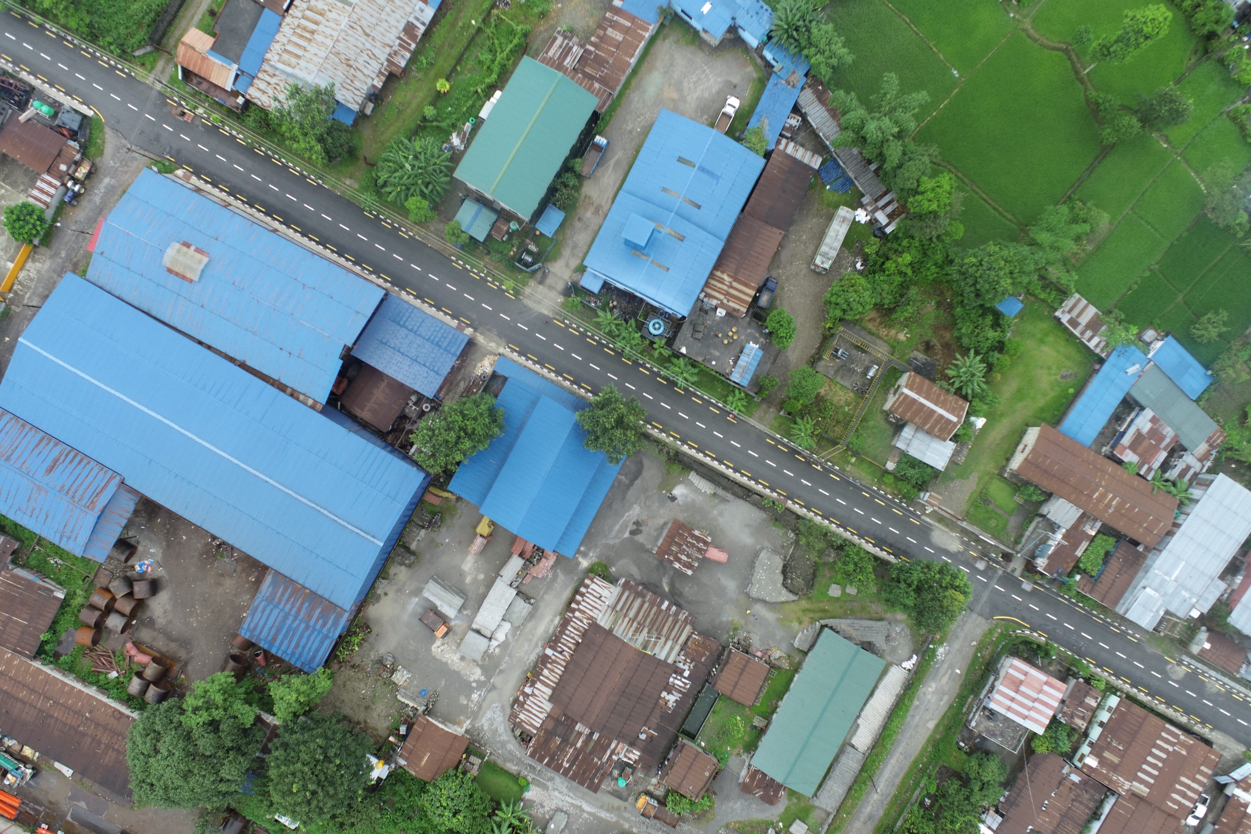
Bheemdutta drone survey and mapping
The technical team from Geovation Nepal carried out an airborne survey in two wards (Ward 04 and Ward 18) of Bhimdutta Municipality. The obtained high resolution images were used to generate a high resolution orthomosaic, Digital Elevation Models. A geodatabase that includes natural and manmade features such as building footprints, road lines, openspaces was prepared through these outputs to prepare topographic maps, Landuse maps. These results were used for house survey, humanitarian open space mapping and to identify present condition of roads within two wards.
Portfolio
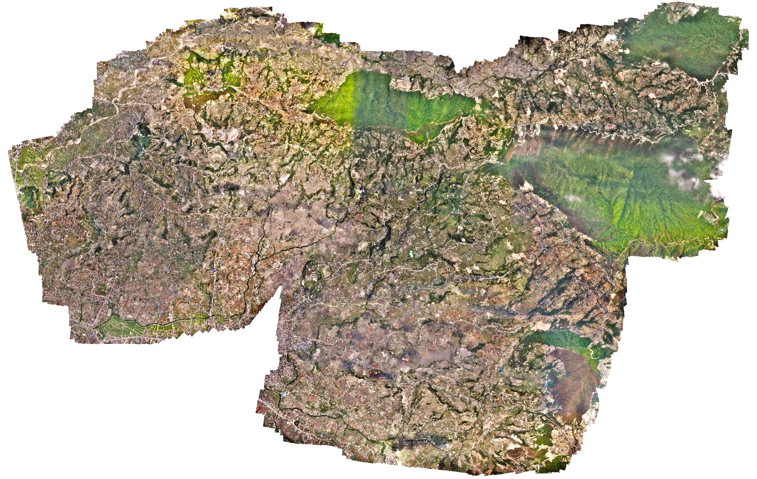
High resolution survey of an Urban municipality
Changu Narayan Municipality, an urban municipality in Kathmandu, approached Geovation to deploy our long-range drone to rapidly capture high-resolution drone images of the entire municipality. The work had to be carried out within nine days as the site was close to the airport. However, due to the ongoing COVID cases in the country, the imposed lockdown provided a limited traffic air space for easy deployment of the drones. Within 9 days, a 42-megapixel high-definition RGB sensor captured 11,000 images covering a total area of 64 square kilometers. The municipality later used those images with other tech consulting companies to generate street names and household numbers and also used them as baseline imagery in the open data portal.