Portfolio Type: Survey & Mapping
Portfolio
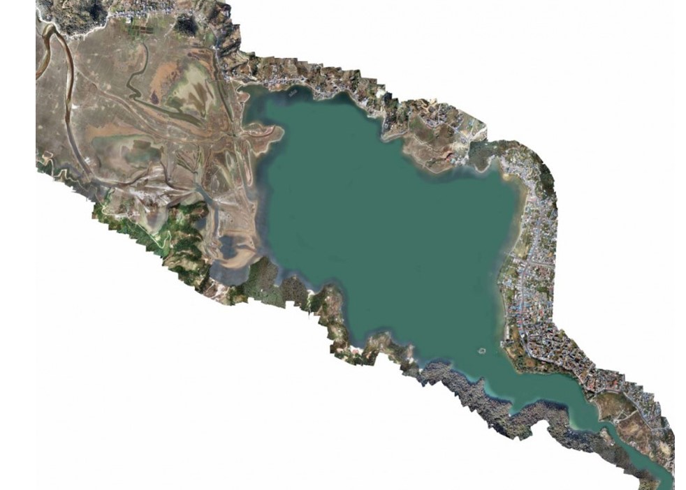
Drone based aerial survey of Phewa Lake
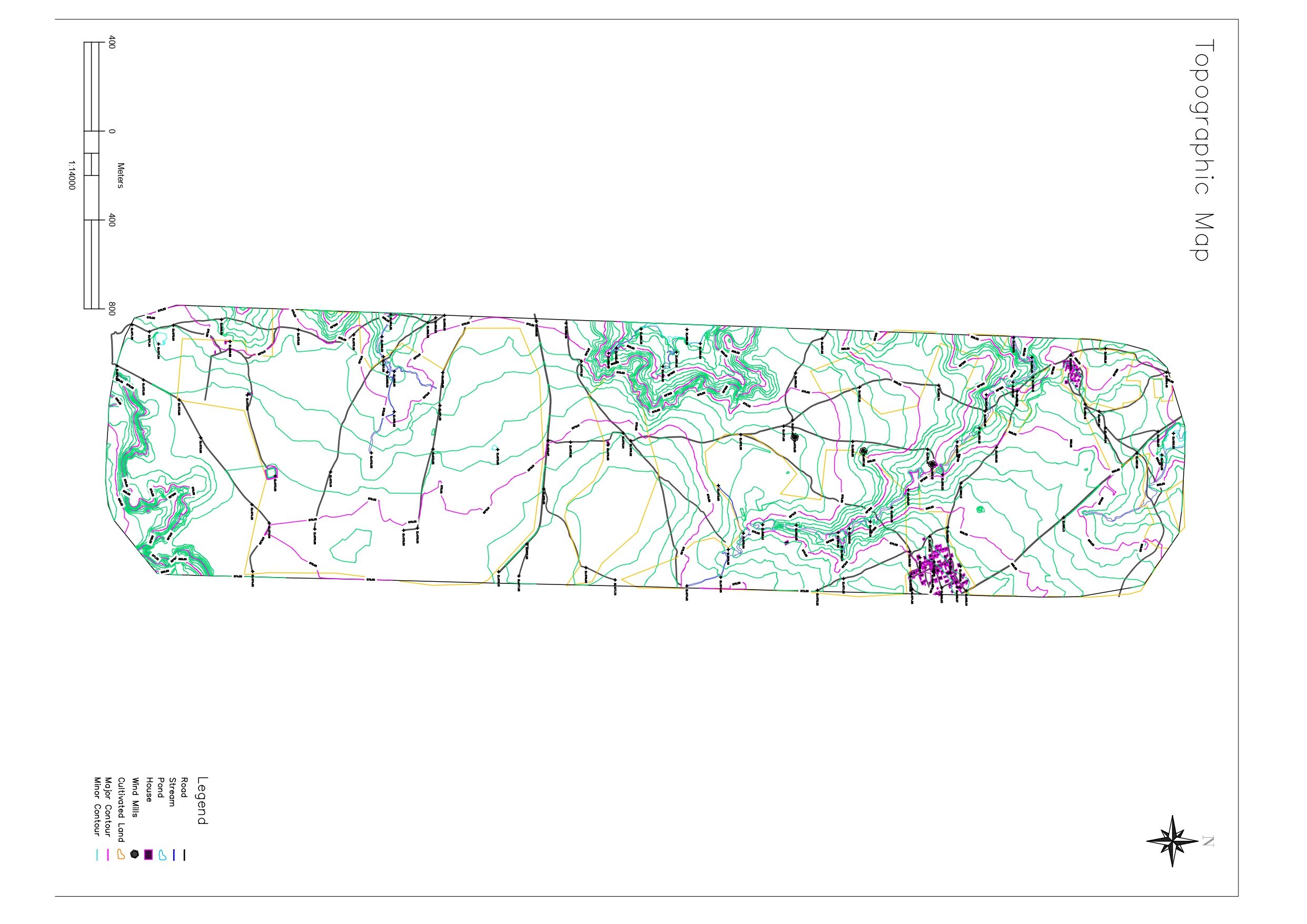
Geovation Nepal carried out an aerial survey using a drone to capture high-definition, geotagged images of Phewa Lake and its surroundings. Our team processed these images in image processing software to produce orthomosaics and elevations. Then, the obtained results were further analyzed and used to identify, demarcate, and map the Phewa Lake boundary in the MUTM (Modified-UTM) system.
Portfolio
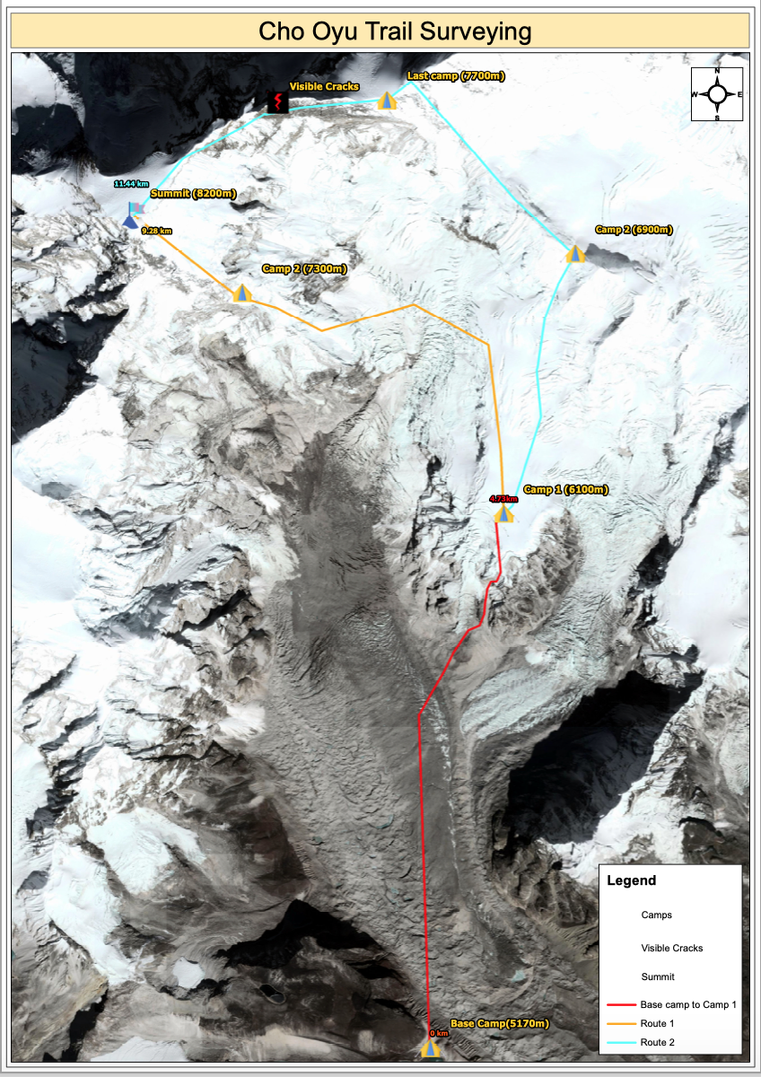
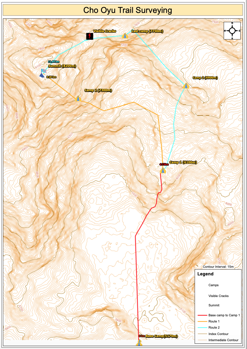
High altitude Trail mapping and Surveys
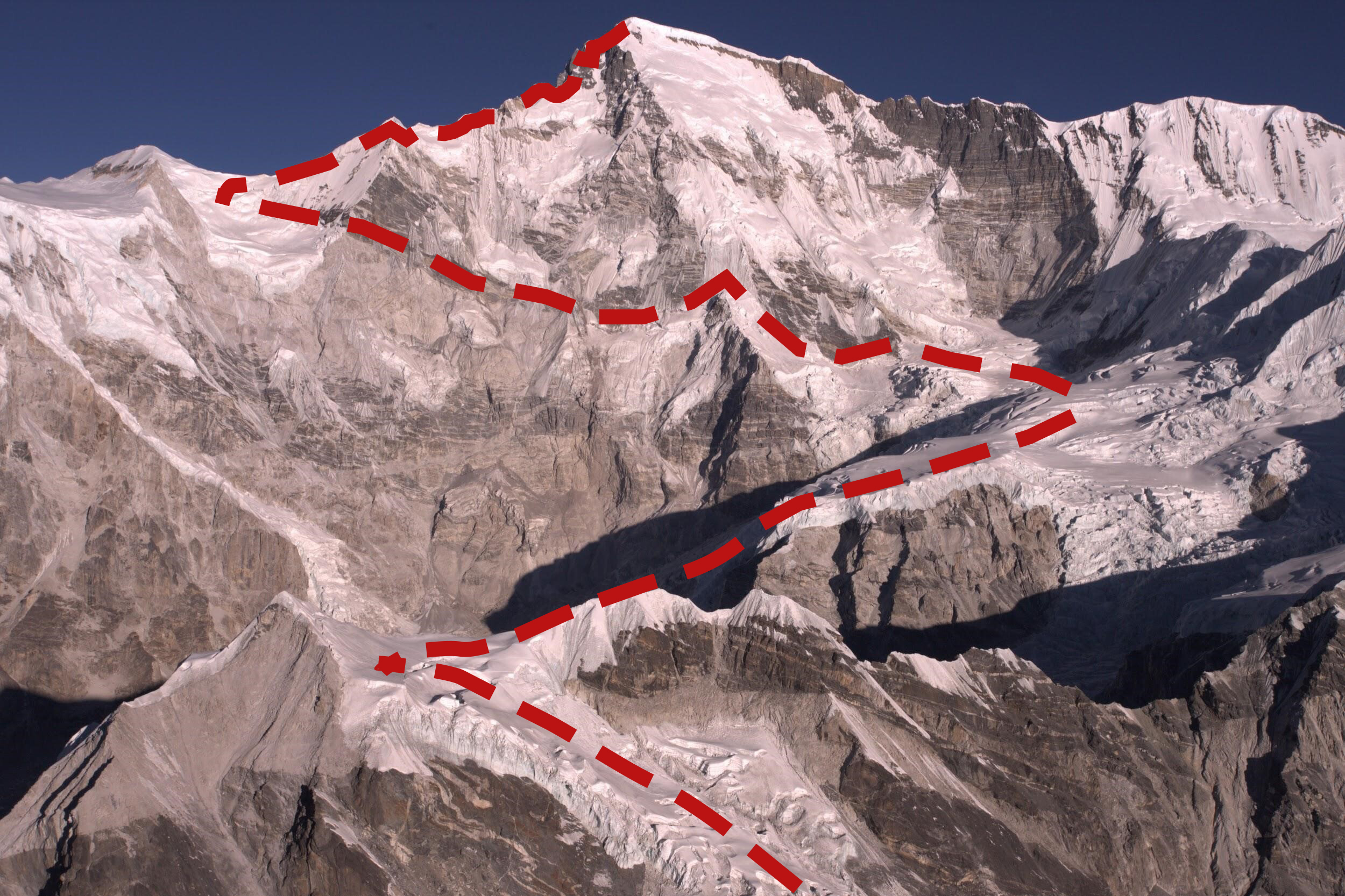
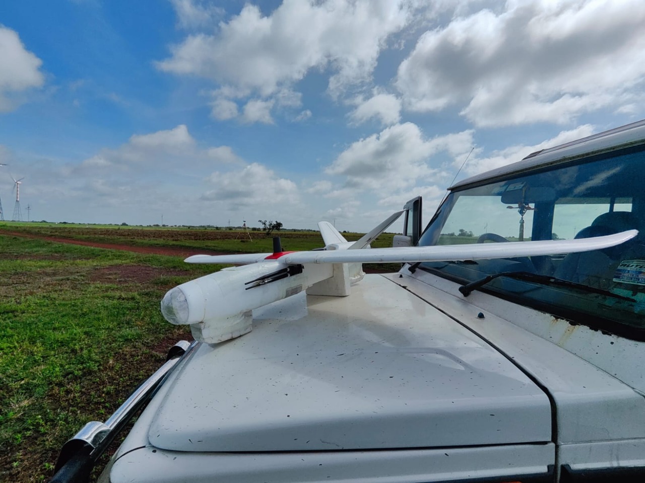
Mt. Cho- Oyu (8201m) in the Khumbu Himalayas under the Mahalangur Range is the fifth highest mountain in Nepal and the sixth highest in the world. Located in Nepal and the People’s Republic of China, this mountain is one of the most popular mountains for mountaineering tourists. Hundreds of climbers apply for the permit to climb this mountain every year, the technical aspects of this mountain are full of diversity, making it the choice of mountaineers. In this regard, a recce trip was made to explore the area prior to the technical team’s task. A team led by the representatives of the Ministry of Culture, Tourism, and Civil Aviation, the Department of Tourism, the Nepal Tourism Board, and the Nepal mountaineering Association headed to the region for the aerial study. A drone pilot and a photographer accompanied the team for visual documentation.
The aerial recce trip was conducted to understand the terrain of the mountains in order to identify the safe mountaineering route for commercial mountain climbing. The route which mountaineers follow from the Nepal side has very little ascent, is technically difficult and has had cases of accidents with casualties. The team also projected an orthophoto map that identified big cracks and possible risks in the route.
Portfolio
Hyderabad, India – Drone Based Aerial Survey
The firm had successfully completed its first international project for Hyundai Motor Company in India. The project objectives were to conduct drone based aerial surveys for capturing high resolution imageries for a construction site. Furthermore, to use the collected images to generate 2d models i.e Orthomosaic, DSM and DTM as well as 3d point cloud and 3d model, finally converting the processed data to CAD compatible format for designing and construction of the new manufacturing plant.